Date:
Wednesday, November 1, 2017


You can contact LEARNZ, part of CORE Education, at:
Postal Address:
PO Box 13 678,
Christchurch 8141,
New Zealand
Kia ora koutou,
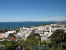
You woke to another stunning day in Napier this morning. Your first task for the day was to head out to the airport to pick up Ursula Cochran. Ursula is an earthquake geologist based in Wellington. She has worked a lot in Hawkes Bay and was keen to share her knowledge of the area. It didn’t take long to get to the airport which is located north of Napier. This whole area used to be a lagoon until it was uplifted during the 1931 earthquake.
Questions from Edendale School
Luckily Ursula’s flight was on time and you could head back into town to complete the web conference with Edendale School. Ursula enjoyed answering students’ thoughtful questions and we all learned so much. I never knew that there is a massive extinct volcano under the sea at Piha. You can find out more by listening to the recording of this web conference.
A hidden fault
Following the conference Ursula took you out to the Awanui Fault. It was movement on this hidden fault which caused the 1931 Napier earthquake. This fault is buried under the earth's surface and the earthquake didn't break it. Instead it heaved up the land, setting off two smaller faults which broke on the surface. The sea floor off Hawke's Bay was lifted more than 2.7 metres, and the Ahuriri Lagoon and tidal flats were drained. There was no obvious sign of where the fault was. It was hard to imagine that we were standing on top of a fault that had caused New Zealand’s worst natural disaster. Ursula explained that people knew where the fault was from the way the land moved on either side of the fault. You can see this in the video.
Finding faults
Geologists are a bit like detectives. They can look at evidence in the landscape to find out what has happened in the past. Faults look like cuts in the land’s surface and often show up most in aerial photos or in cliff faces. You saw faults yesterday in the cliffs at Cape Kidnappers. Geologists have mapped all the known faults and you can see these on the GNS active fault database. It is important that we know where faults are, so we can avoid building on them. Geologists can then study these faults to work out how often they are likely to cause earthquakes and how big these earthquakes might be.
Where’s the evidence?
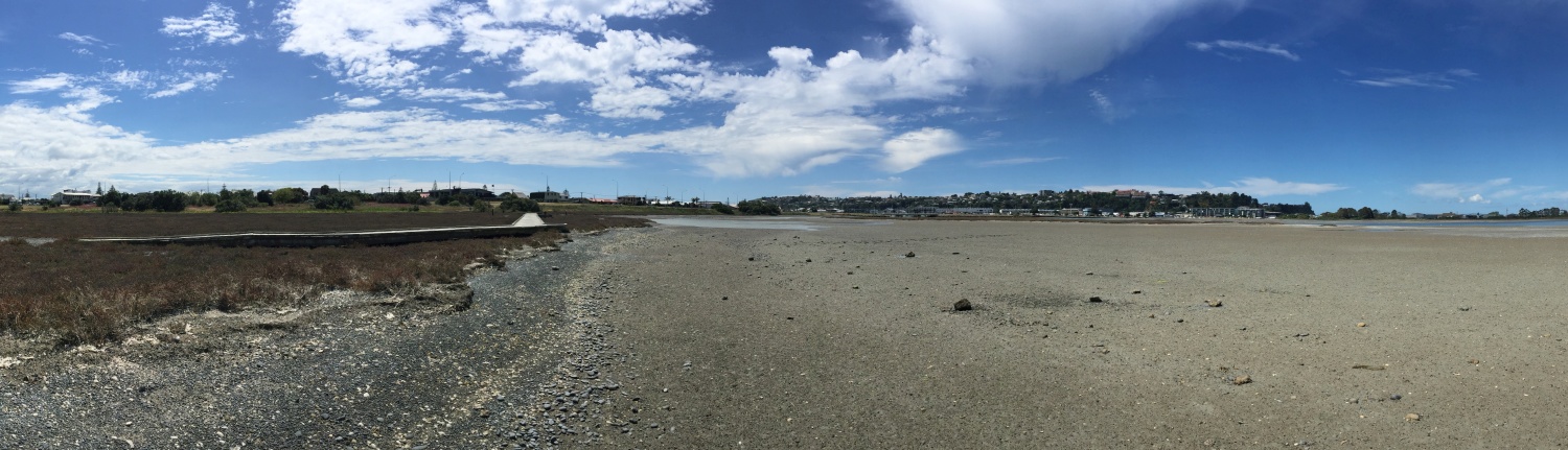
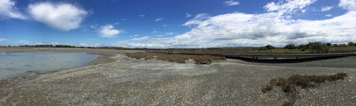
Ursula wanted to show you evidence of uplift from the 1931 earthquake, so she took you to the Ahuriri Estuary. Here you could see a small bank with old sea shells embedded in it. These shells have been identified as a type that only lives under water. This tells us that this area has been uplifted out of the sea. Geologists often look at things like fossils and shells, to work out what has happened to the land and how much it has moved.
Land that liquefies
As you wandered back along the edge of the estuary your feet sunk into the mud. This reminded Ursula of another geological hazard. When the land shakes during an earthquake soft ground such as mud or sand can lose its strength, and liquefy. You can see a demonstration of this in the video. Liquefaction leads to land sinking and water moving up to the surface. Liquefaction was a big problem in Christchurch following the Canterbury earthquakes. It is important for people to know about the type of ground they build on. Tomorrow you will look more at how buildings are designed to survive earthquake shaking and liquefaction.
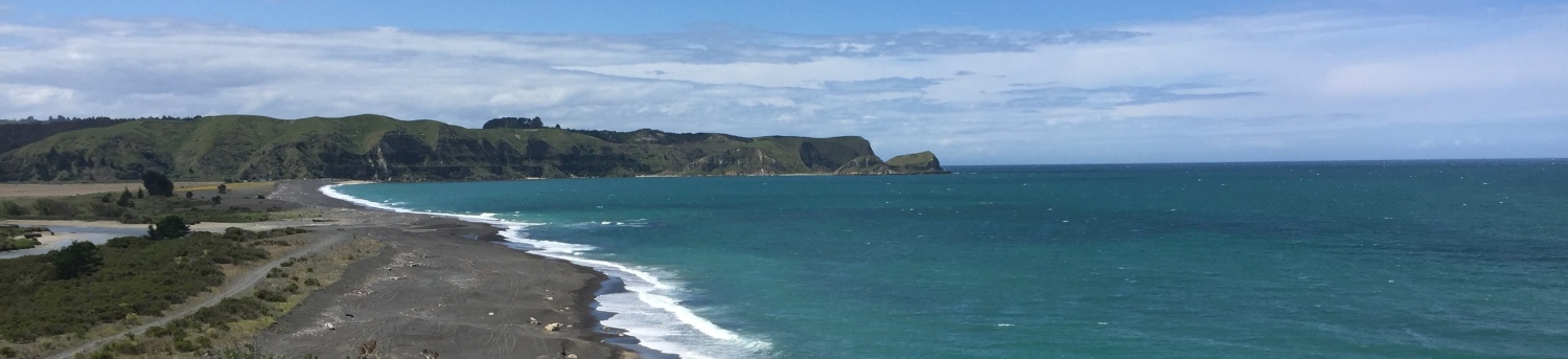
Tsunami
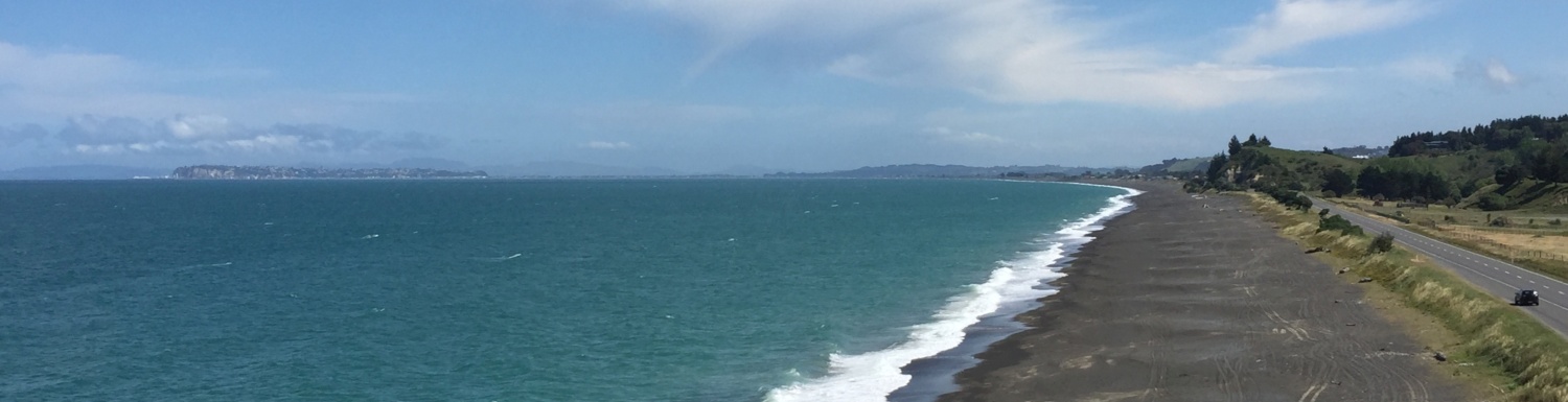
Like many cities in New Zealand, Napier is built on the coast. This means that people need to know what to do if there is a tsunami. Ursula talked about what causes tsunami. Tsunami can occur if the sea floor moves, usually during an earthquake or landslide. You may be able to think of other events that can also cause tsunami. The Hikurangi subduction zone off the East Coast could cause a large earthquake and tsunami. Because this fault is close to the coast people may only have 10 minutes after a big earthquake before a tsunami hits. Everyone living on the coast needs to know where to go if there is a tsunami. Sometimes there is not enough time to know if an earthquake is offshore and can cause a tsunami. So, if an earthquake is long or strong and you are on the coast you need to move to higher ground. You can find out more by watching the video.
You now know about the natural hazards in Hawkes Bay. Tomorrow you will look at how to identify hazards in other parts of the country and how to manage these hazards.
See you then,
Shelley the LEARNZ field trip teacher.

Ursula and Shelley talk to Edendale School during the web conference this morning. Image: LEARNZ.

Ursula and Shelley show the 8m of sideways movement that happened on the Awanui Fault when it moved during the 1931 Napier earthquake. Was there any vertical movement during this quake? Image: LEARNZ.

Alvin looks at old sea shells that were once underwater before being uplifted during the 1931 Napier earthquake. Image: LEARNZ.

Shelley and Ursula stand in front of land that used to be a lagoon until it was uplifted during the 1931 Napier earthquake. How do geologists know that this land was uplifted? Image: LEARNZ.

Ursula shakes a container of mud to show how it liquefies during an earthquake. Image: LEARNZ.

Looking south towards Napier. People living on the coast need to know the warning signs of tsunami and what to do. How would you know if there is going to be a tsunami? Image: LEARNZ.

The Pakuratahi Valley would be flooded if a tsunami hit the East Coast of the North Island. Image: LEARNZ.

Shelley and Ursula enjoy the view out over the ocean and talk about tsunami risk on the East Coast. Image: LEARNZ.