During the field trip panorama photos are taken which help students orientate themselves to the field trip environment. Panoramas will appear here during the field trip and may include 'Interactive' panoramas as well as 'still image' panoramas. Questions from the captions are best answered after watching videos, reading a diary, or listening to an audioconference.
Still image panoramas
click any photo for an enlargement
Saturday and Sunday 1-2 November
 Saturday. Looking up to Scott Base from the sea ice. Scott Base is New Zealand’s permanent base in Antarctica on Ross Island. How do you think Scott Base is powered? Can you see the pressure ridges in the ice? What do you think causes these pressure ridges?
Download image
 Saturday. Hut Point Peninsula from the sea ice in McMurdo Sound. Can you see McMurdo Station? How do people know where to drive on the sea ice and what do they have to do to make sure cracks in the sea ice are not too wide to cross?
Download image
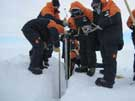
 Sunday. Hagglunds are one of the vehicles that are used to drive on the sea ice. What other forms of transport are there? What design features does a Hagglund have to allow it to travel on ice?
Download image
Monday 3 November
 Monday. Looking up toward the hut at Cape Bird. Can you see the Adelie penguins? How do you think these birds have adapted to life in Antarctica and why do you think the hut has been built here?
Download image
 Monday. The view from the hut out across the sea ice. This sea ice moves – what do you think causes it to move?
Download image
 Monday. Looking from the sea ice back towards Mount Bird. Can you see the penguins up the hill? Why do you think the penguins have built nests so far up the hill?
Download image
Tuesday 4 November
 Tuesday. Looking out over Cape Evans and the dive hut where the scientists are diving under the sea ice. Why do you think they need a hut and how do they manage to dive below the ice?
Download image
 Tuesday. This is Terra Nova hut at Cape Evans. How can you tell this is an old hut and why is this hut famous?
Download image
Wednesday 5 November
 Wednesday. Looking up towards the main buildings of Scott Base from outside the laboratories. What do you notice about the way these buildings have been designed and how do you think this helps to keep the base warm?
Download image
 Wednesday. The view from Observation Hill behind Scott Base. Can you see Scott Base? What is the name of the base on the left? What differences can you see between the two bases?
Download image
Thursday 6 November
 Thursday. The dive hut on the sea ice at Cape Evans wall is right under the glacial ice of Mount Erebus. How high do you think this ice wall is and why do you think this would be an interesting place to dive under the sea ice?
Download image
 Thursday. Looking back towards the dive hut at Arrival Heights near McMurdo Station. Do you think the divers will see different animals when diving at this site compared to the site at Cape Evans Wall and why do you think this?
Download image
Friday 7 November
 Friday. The dive hut at Little Razorback Island was the last dive site that the science team went to. Can you see Mount Erebus in the background erupting? How high do you think this mountain is and what kind of volcano is it?
Download image
 Friday. Little Razorback Island and Razorback Island directly behind it. How do you think these islands got their name. There are usually seals around this island. Why do you think there were none here this year?
Download image