You can contact LEARNZ, part of CORE Education, at:
Postal Address:
PO Box 13 678,
Christchurch 8141,
New Zealand
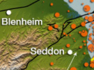
New Zealand is geologically active and therefore at risk from geohazards. By monitoring, modelling and finding geohazards people can be ready for them. In New Zealand the GeoNet project (funded by EQC) does the monitoring.
GNS Science looks after the GeoNet project and is monitoring our earthquakes, large and small, and our active fault lines to understand past events, and prepare for the future.
To better understand earthquakes scientists work on;
There are 12 active volcanic areas in New Zealand. Although the probability of an eruption affecting a large area is low in any one year, New Zealand needs to be prepared for different kinds of volcanic eruptions.
The GeoNet project (GNS Science) monitors active volcanoes to find the early signs of volcanic activity. This equipment is also used to study the impacts of eruptions and model future eruptions.
To better understand tsunami and the risk for New Zealand, scientists work on;
Unstable land, heavy rainfall, earthquakes and people changing the land can lead to landslides. Studying the strength of the ground, landslide events and triggers and locating faults can help us to understand landslides better.

,GNS Science looks after the GeoNet project which monitors earthquakes, volcanoes, landslides and tsunami. This is a seismometer to measure ground movement; how do you think it works? Image: LEARNZ.

,Devices such as this make up the Eruption Detection System on Mount Ruapehu. Why is a warning system so important on Mount Ruapehu? Image: LEARNZ.

A tsunami gauge recording showing the tsunami at Raoul Island after the 2011 7.6 magnitude earthquake in the Kermadec Islands. Image: GeoNet.
Visit the GeoNet website to learn more about monitoring geohazards.