You can contact LEARNZ, part of CORE Education, at:
Postal Address:
PO Box 13 678,
Christchurch 8141,
New Zealand
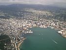
I am working at Land Information NZ for a few months to help identify common problems the social agencies have in finding and locating people and support the team here with their work. This means I can walk all around Wellington to “locate” smart “people” working with data in each government department like Health, Education, Corrections, Social Development, Housing NZ, Police and others.
I sit next to Geoff who is supporting the LEARNZ trips, so I’ve offered to be the “base” and make sure everything runs smoothly behind the scenes in the office.
I’m on loan here for a little while and I usually work as the mapping team leader at the Department of Conservation.
I have been working in geography for a long time. I’ve worked in health, conservation, treaty settlement negotiations, international development (Iraq, Afghanistan) and the NZ mapping software provider for mapping software.
Here is a fun video that will give you a taste https://youtu.be/KmM4QQaRpF4 of my work with Māori claimant groups.
I really enjoy being able to get out and teach people how to use free easy mapping tools like Google Earth and MyMaps to help them share information about their work and to keep track of whatever project they’re doing.
That would have to be timesheets, filing my receipts, and fixing jams in the photocopier.
I am helping Geoff get setup with a variety of tech for his epic virtual fieldtrip adventure on boats, planes and trains by testing GPS apps to track him when he is out in the field and to be able to share it with everyone each evening.
These videos were fun to make and combine thousands of photos into a timelapse of a “day in the life” of one of my earlier jobs: https://youtu.be/02vBpzJ7Bu8
I was working for USAID teaching Iraqis how to use mapping software to track water pipes, electricity networks and planning urban development. We were at a city north-west of Baghdad, and after visiting the staff at a governance centre I was getting back up into a heavily armoured transport truck when I was hooked on the four tonne door by my body armour. Hilarious. Once I managed to unhook and continue getting into the truck, a guy in a nearby building decided to shoot me in the back from a few hundred metres away. It was a great shot, right in the middle of my ceramic plate armour. But, it did kind of hurt and was quite annoying.
Fifteen minutes later, the 4 story building he was hiding in no longer existed. I learnt you should not mess with the US Marine Corps. Huah.
Here's a wee video of my time in Iraq: https://youtu.be/468mDQp8Q_8
I completed a Masters in Social Sciences at Waikato in Health, Environmental Science and GIS. No one has ever asked me what grades I earnt, or what papers I did, but the letters are important in getting a foot in the door, so if you can I recommend completing a masters in your field of interest. From about 2004 I became interested in managing projects in my areas of interest and I find them just as valuable.
I love taking photos of things, here are some photos of Jupiters Moons, Mars, and Saturn: https://youtu.be/de2LjQ5F3HE I am a real social media junky. You can read some of my blogs on LinkedIn: https://www.linkedin.com/today/author/0_2DlqGdJ5mWuaCAmDFehN8z?trk=prof-... follow me on Twitter @pm4gis https://twitter.com/pm4gis

Duane Wilkins is a mapping team leader at the Department of Conservation. He is currently temporarily working with LINZ. Image: DOC.