Date:
Wednesday, August 30, 2017


You can contact LEARNZ, part of CORE Education, at:
Postal Address:
PO Box 13 678,
Christchurch 8141,
New Zealand
Kia ora koutou,
Yesterday you looked at Wellington's resilience to earthquakes. Today you shifted your focus to tsunami. New Zealand sits on a tectonic plate boundary. Many of our cities are also on the coast, so we all need to prepare for tsunami.
What causes tsunami
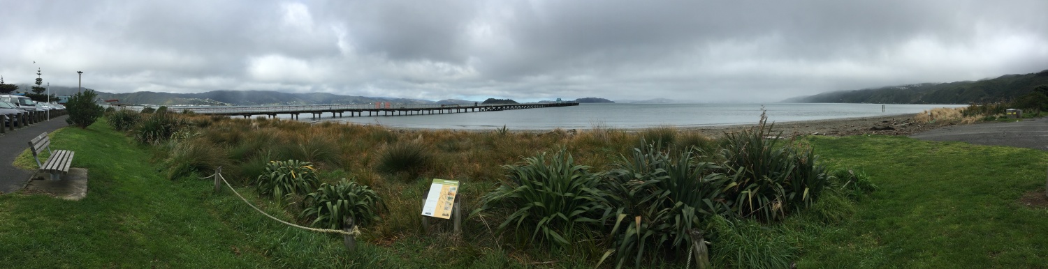
You started the day at Petone where you met with William from GNS Science. William is a tsunami scientist and he talked about what a tsunami is and how it could affect Wellington. Tsunami can be triggered by any large movement on the seafloor. Earthquakes, landslides or volcanoes that occur under the sea can all cause tsunami. Large island volcanic eruptions and even meteor impacts can also trigger tsunami. Earthquakes are the most common cause of tsunami, but not every under sea earthquake will cause a tsunami. Earthquakes generated by a subduction zone cause the largest tsunami. This is because one side of the fault moves up while the other moves down, displacing more water. Tsunami don’t just happen on the coast. William told you about lake tsunami caused when land slides into a lake creating a wave.
From virtual to reality
You visited Wellington City Council’s lab to see how they are preparing for tsunami. Here you met with Sean Audain who is an Innovation Officer with the council. Walking through the lab you could see all sorts of devices and machinery. Wellington is working on increasing its resilience by using technology. Sensors are being placed all around the city. These sensors track things like noise, air pollution, lighting, traffic, and pedestrians. This improves the council's understanding of the environment, and how people behave. All this information can also help with planning for emergency events. You managed to borrow a head set to trial the new Virtual Reality 3D city simulation. It felt strange at first until you understood how to navigate your way around. You could see how different buildings would be affected by earthquakes. You could also watch as the water rose up to 8 metres during a tsunami. You can see this in the video.
You had to return from the virtual world to the real one to complete the web conference. Students from Miramar Christian School asked lots of questions about tsunami. It was interesting to hear that a tsunami caused more damage during the 1855 Wairarapa earthquake than the quake did. You can find out more by listening to the recorded web conference.
Tsunami sources
Wellington could be affected by a local tsunami, or a tsunami that begins thousands of kilometres away. People may get over 12 hours of warning or only a few minutes. This is why it is so important to move to higher ground if an earthquake is strong enough that you can’t stand up, or lasts longer than a minute.
Monitoring tsunami
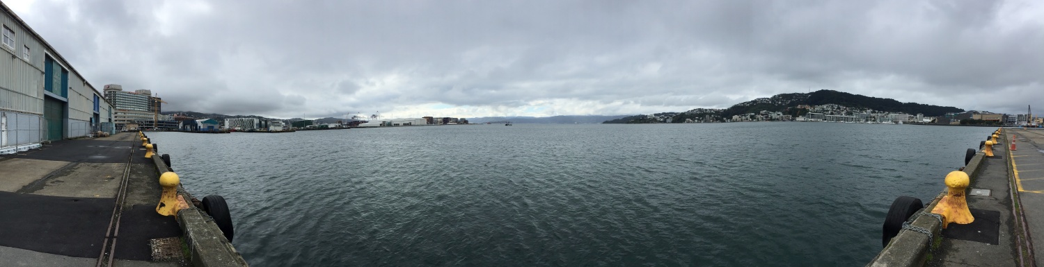
To find out more about how tsunami are measured you headed back into the centre of Wellington to look at a tide gauge. A tide gauge measures sea level. Tide gauges, coastal seismometers and buoys form a New Zealand tsunami monitoring network. This network is part of a larger Pacific Ocean network. This network gives tsunami warnings and helps scientists to better understand tsunami. Glen Rowe from LINZ showed you a tide gauge on the Wellington waterfront. The gauge was not visible as it was beneath the wharf. But you could see the data logger and devices used to send information from the gauge to GeoNet. Glen also showed you how information from tide gauges is graphed. You can see this on the video.
Tsunami evacuation zones
Students from Owhiro School have been learning about tsunami. The whole school has practiced tsunami evacuation drills. They are able to reach high ground within minutes of a tsunami warning. Blue lines have been painted on the road to show where it is safe to evacuate to during a tsunami. Four students took you to a tsunami safe zone above the school. The students recorded a GPS location of these lines, which they used to work out how many metres above sea level they were. They then added this information to a map. From this map, they could work out which students needed to evacuate their homes during a tsunami. It was fantastic to see how much these students knew about tsunami. This knowledge is helping these students to become more resilient.
Tsunami evacuation zone maps have been created by the Greater Wellington Regional Council. These maps show which areas of Wellington must be evacuated. You can see these maps here.
Over the past two days you have learned a lot about how to build resilience to earthquakes and tsunami. But these events do not happen often. Tomorrow you will look at flooding, one of New Zealand’s most common natural hazards.
See you then,
Shelley the LEARNZ field trip teacher.

Petone is one of many areas in Wellington that could be affected by a tsunami. Image: LEARNZ.

Shelley talks to William, a tsunami scientist about tsunami risk in Wellington. Image: LEARNZ.

Shelley takes a virtual reality tour of Wellington. Image: LEARNZ.

Sean Audain from Wellington City Council shows the sensors that are used to monitor things like noise levels, congestion and air pollution in Wellington. Why is it useful to collect this information? Image: LEARNZ.

Glen shows Shelley a tide gauge used to help monitor tsunami. Image: LEARNZ.

This tide gauge is part of a national network. Tide gauge information is shared through GeoNet. How is this information recorded? Image: LEARNZ

Students from Owhiro Bay School show where the tsunami safe zones are near their school. Image: LEARNZ.

The location and height of tsunami evacuation zones can be recorded and mapped to help inform people about where to go if there is a tsunami. Image: LEARNZ

Owhiro Bay School students and Shelley talk about what to do if there is a tsunami. Image: LEARNZ.
