Date:
Thursday, May 24, 2018


You can contact LEARNZ, part of CORE Education, at:
Postal Address:
PO Box 13 678,
Christchurch 8141,
New Zealand
Kia ora koutou, After the stormy weather of the last few days it was nice to wake up to blue skies and sunshine. You started the day at the University of Otago School of Surveying. This is where students come to learn about the art and science of surveying. Surveyors are experts in measuring and they like to be accurate!
Your mission for the day is to find out how surveyors make measurements and why. You began by joining Chris Pearson and Robert Odolinski for the web conference. You spoke to Tauranga Intermediate and Adventure School. These students were interested in how GPS satellites work and the future of spatial technology. It was interesting to hear from Robert that he thinks mobile phones will become even more powerful and accurate. In the future it won’t be just experts that can make maps and GIS programmes, but anybody who has an interest in sharing location-based information. You can find out more by listening to the web conference.
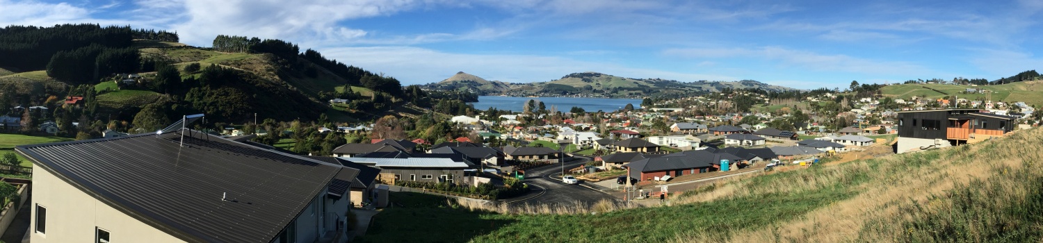
After the webconference you met Richard Hemi a lecturer at the University of Otago School of Surveying. Richard wanted to show you how surveyors find and map property boundaries. He took you out to a new subdivision in Sawyers Bay where properties have been surveyed and boundaries marked with white pegs. These white pegs have the lot number on them and show where one person’s property ends, and another’s starts. It’s important for these boundaries to be accurate so people know how much land they own and what they are responsible for. The ambassadors found a few boundary pegs buried in the grass and could see where new sections have been marked out.
In cities and towns surveyors need to be within 4 centimetres of accuracy but in rural areas they only need to be within 20 centimetres of accuracy. This is because often fence posts on farms are around 20 centimetres in diameter. Conservation areas are mapped with an accuracy of 60 centimetres because trees are often this big and there is no need to be any more accurate. This allows surveyors to map larger areas more quickly. You can watch the video where Richard explains how properties are surveyed.
You headed back to the School of Surveying to talk to Robert about his work. Robert is a researcher and has been looking at how accurate GPS is. We often think that the GPS location which our phone gives us is very accurate. But it only works within about 5 metres of accuracy, which is not nearly accurate enough for surveyors. To get better accuracy surveyors need more base stations to work from. The exact location of base stations is known so the location of nearby objects can also be found. Robert hopes that in the future we will be able to know much more precisely where things are. More navigation satellites can also help with this. Precise positioning could help us not only find the address of a building but also to find our way around that building. Watch the video to find out more.
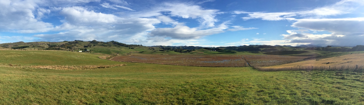
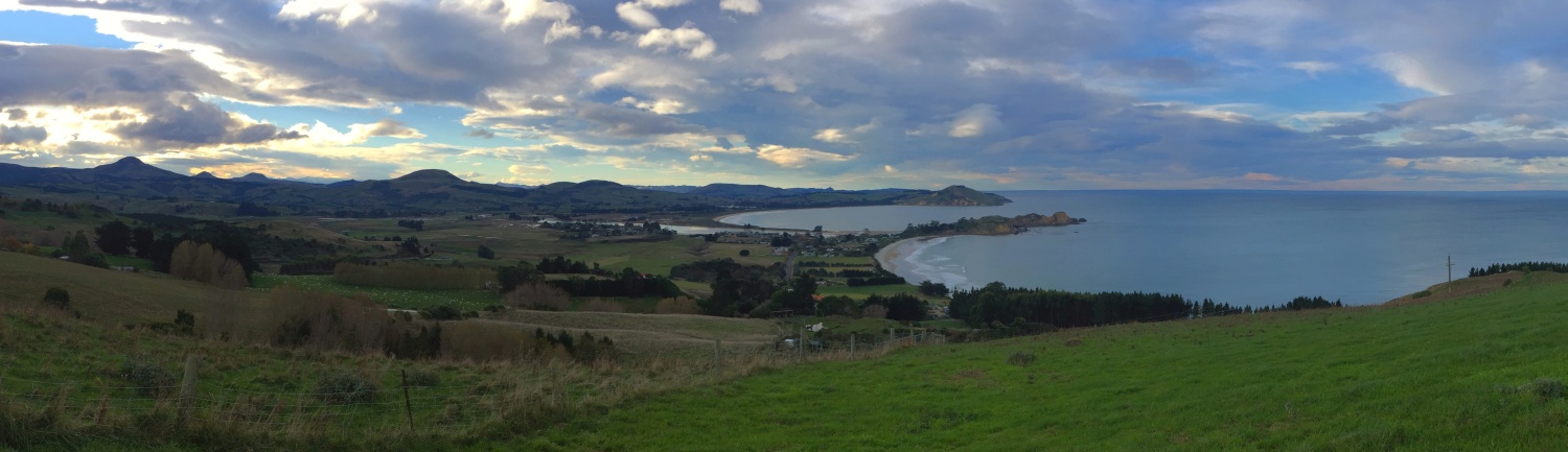
It was then time to head back outdoors to enjoy the sunshine and find out more about the work that Chris and his team have been doing in rural areas. Chris took you for a scenic drive out to Karitane, north of Dunedin. This coastal town is surrounded by farmland and surveyors have been mapping conservation areas. Some property owners are lucky enough to own special areas such as wetlands and forests. These areas can be protected legally by placing a covenant on the area. This means the area is surveyed to show where it is exactly. Then it cannot be damaged or changed in any way, even if the property is sold to someone else. Chris showed you a wetland with a QEII covenant on it. His team has used SBAS technology to survey the wetland. You can find out how this was done in the video. It was fantastic to see that the land owners wanted to protect this wetland and had fenced it off to protect it from stock. You may have an old native tree on your property that could be protected by a covenant so no one in the future can cut it down.
The light was fading as you walked back to the car in Karitane. It has been a very busy few days exploring different forms of technology and I cannot think of a better way to have spent Techweek.
I hope you have enjoyed the field trip and can join us on another one soon.
Mā te wā,
Shelley the LEARNZ field trip teacher.

Shelley, Chris and Robert talk to students from Tauranga Intermediate School and Adventure School during the last field trip web conference. Image: LEARNZ.

Looking out over a new subdivision in Sawyers Bay where surveyors have surveyed and mapped property boundaries. Why do you think these boundaries need to be accurately mapped? Image: LEARNZ.

The ambassadors find a peg marking a property boundary. What are these pegs used for? Image: LEARNZ.

Richard sets up a GPS antennae and receiver to measure property boundaries. Image: LEARNZ.

Robert shows Shelley how a phone receives signals from satellites. The more signals it receives the more accurately it can calculate its location. Image: LEARNZ.

This surveyor is using an old theodolite and chain to make measurements. Image: LEARNZ.
 surveying instrument set. Image: LEARNZ.")
Now surveyors can use equipment that uses GPS satellite signals. This is an RTK (Real Time Kinematic) surveying instrument set. Image: LEARNZ.

This wetland is on private property. It has been surveyed and placed under a QEII covenant to protect it. Image: LEARNZ.