


You can contact LEARNZ, part of CORE Education, at:
Postal Address:
PO Box 13 678,
Christchurch 8141,
New Zealand

Global Positioning Systems or GPS are used to find the exact location of things.
GPS uses the time it takes for signals from four satellites to reach a receiver to calculate an exact location.
GPS are now used all over the world. A GPS unit is a receiver that picks up signals from satellites. Global Positioning System satellites send (transmit) signals to GPS receivers on the ground. Receivers need a clear view of the sky, so they are only used outdoors and do not work well in forests or near tall buildings. The satellites transmit the exact time the signals are sent. By taking the time the signal was transmitted from the time it was received, the GPS can tell how far it is from each satellite. The GPS receiver also knows the exact position in the sky of the satellites, at the moment they sent their signals.
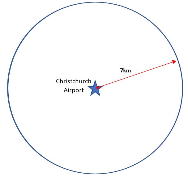
Imagine you are somewhere in Ōtautahi Christchurch, and you are totally lost. You have absolutely no clue where you are. You find a friendly local and ask, "Where am I?" he says, "You are 7km from Christchurch Airport”. That is good hard evidence, but it means you could be anywhere on a 7km circle around the airport.
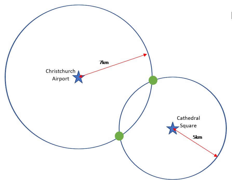
You ask someone else where you are and she says, “you are 5km from Cathedral Square”. Now you're getting somewhere. If you combine this information with the Christchurch Airport information, you have two circles that intersect. You now know that you must be at one of these two intersection points (green dots).
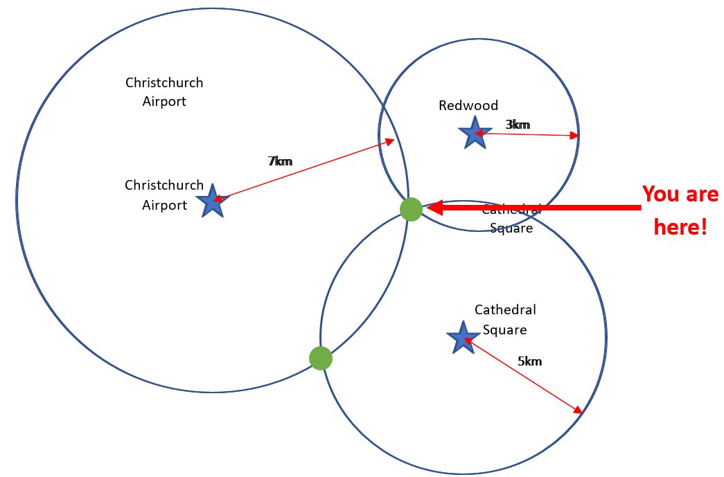
A third person tells you that you are 3km from Redwood. You can now eliminate one of the possibilities, because the third circle will only intersect with one of these points.
You now know exactly where you are: Papanui!
Watch this Youtube video to find out more about how GPS works.
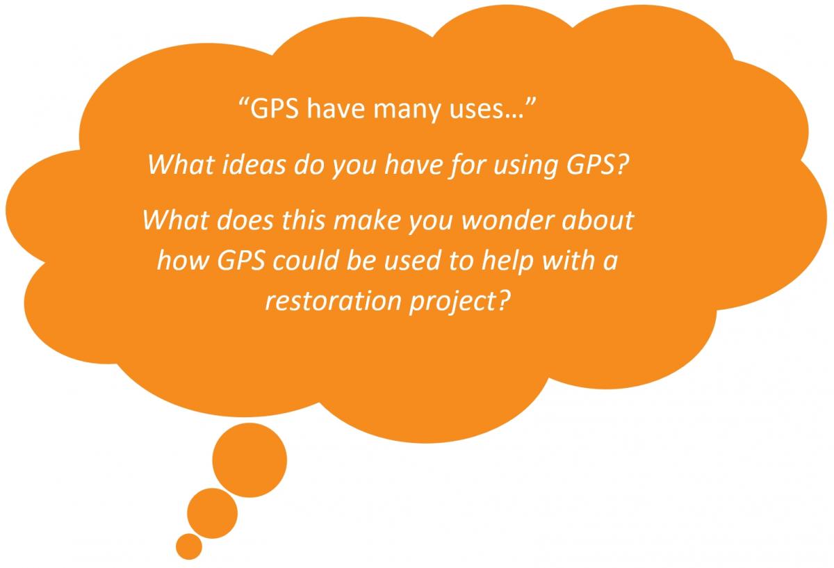
The GPS has many uses. GPS can be used for tracking and navigation. Devices such as some smartphones and watches can use GPS.
GPS can be used in many ways, for example;

A new system known as SBAS (Satellite Based Augmentation System) is being trialled in Australia and Aotearoa to improve the accuracy of GPS signals. This system will make existing satellite navigation systems like GPS even more accurate and reliable than they are now. GPS usually provides positioning information accurate to about 5-10 metres. This new system will improve the accuracy to less than a metre, and in some devices to 10 centimetres.
Complete the GPS quiz >
A SBAS operates through the deployment of a series of reference stations monitoring signals broadcast by Global Navigation Satellite System (GNSS) satellites, and compares the station’s known location with the position data from the satellites.
The GNSS signal data and measurement information is then transmitted to a Central Processing Facility. This facility produces error corrections and status information about the GNSS satellites as a series of messages. These messages are sent to an uplink station, which transmits the data to a geostationary satellite. This data is then re-broadcast as an augmentation of the GNSS satellites to all precise positioning users
> Discover more about mapping technology and restoration