Who has heard of GPS?
GPS stands for Global Positioning System. GPS are now used all over the world. A GPS unit is a receiver that picks up signals from satellites.
Global Positioning System satellites send (transmit) signals to GPS receivers on the ground. Receivers need a clear view of the sky, so they are only used outdoors and do not work well in forests or near tall buildings.
The satellites transmit the exact time the signals are sent. By taking the time the signal was transmitted from the time it was received, the GPS can tell how far it is from each satellite. The GPS receiver also knows the exact position in the sky of the satellites, at the moment they sent their signals.
How GPS Works
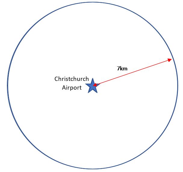
Imagine you are somewhere in Christchurch and you are totally lost. You have absolutely no clue where you are. You find a friendly local and ask, "Where am I?" he says, "You are 7km from Christchurch Airport”.
That is good hard evidence but it means you could be anywhere on a 7km circle around the airport.
You ask someone else where you are and she says, “you are 5km from Cathedral Square”.
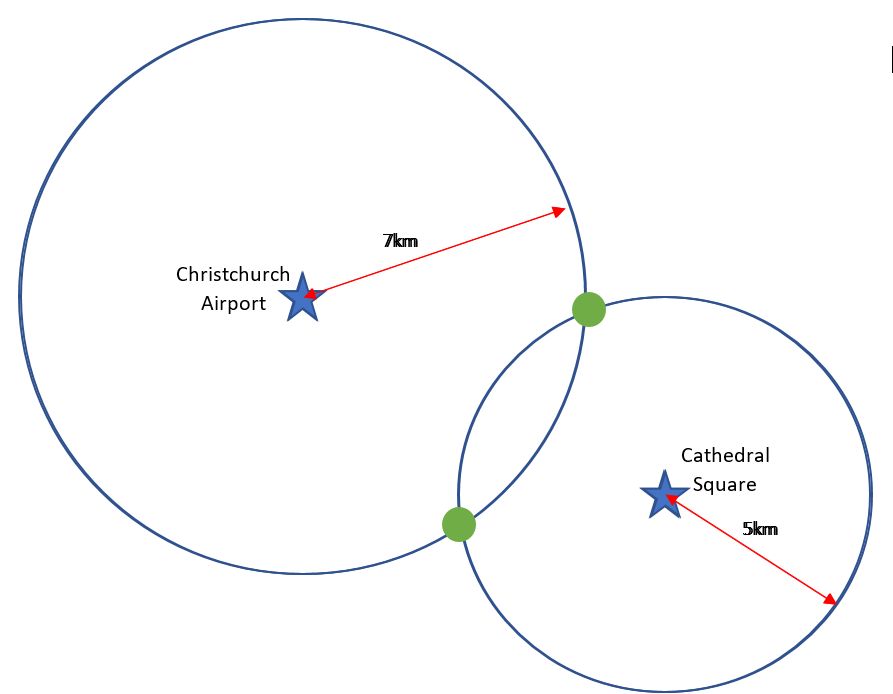
Now you're getting somewhere. If you combine this information with the Christchurch Airport information, you have two circles that intersect. You now know that you must be at one of these two intersection points (green dots).
A third person tells you that you are 3km from Redwood.
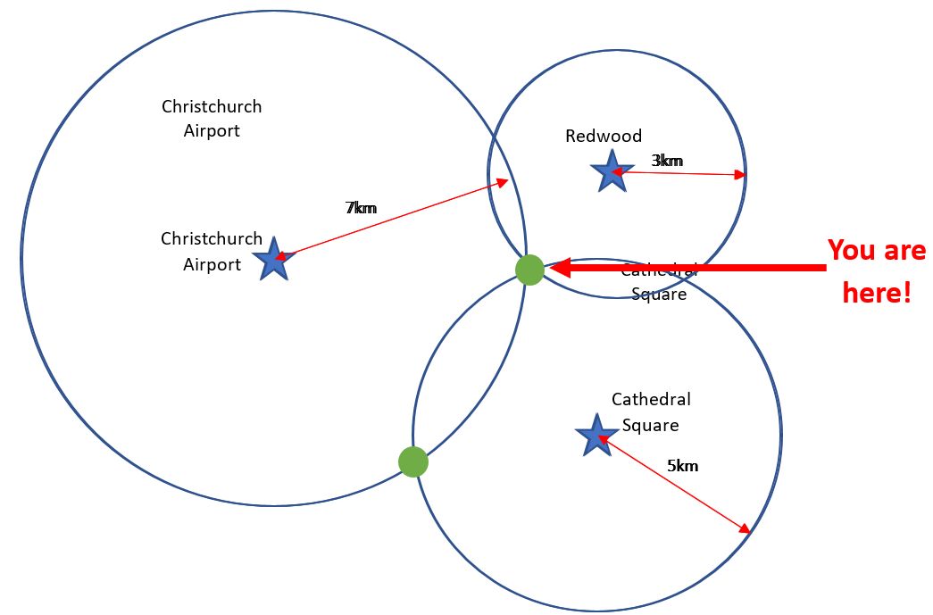
You can now eliminate one of the possibilities, because the third circle will only intersect with one of these points. You now know exactly where you are: Papanui!
Watch this Youtube video to find out more about how GPS works.
Uses of GPS
GPS has many uses, for example;
- Setting time - auto updating cell phone times when daylight saving begins and ends
- Emergency services need GPS to find places
- Tracking a vehicle, aircraft, person or a pet which has been chipped
- Bus stops: to show how long the bus will take to arrive at a bus stop
- Navigation
- Personal Locator Beacons (PLBs): used to tell search and rescue experts where someone is
- Recreation: eg tramping, climbing, diving, sailing
- Surveying: Surveyors use GPS locations to make maps and work out property boundaries
- Tectonics: using GPS the movement of faults during earthquakes can be measured.
Can you think of any other uses for GPS?


