Date:
Monday, September 9, 2019


You can contact LEARNZ, part of CORE Education, at:
Postal Address:
PO Box 13 678,
Christchurch 8141,
New Zealand
Kia ora koutou
It was fine and settled at Russell/Kororāreka this morning. The water in the bay was still but, in the distance, the ambassadors and I could see dark clouds. We just hoped they wouldn’t find their way to Mangahāwea and empty themselves while we were there.
Web conference
Our first field trip web conference took place at Russell Museum/Te Whare Taonga o Kororāreka. Our speaking school was St Patrick’s Catholic School. Andrew Blanshard, an archaeologist from the Department of Conservation, was our web conference expert.
We had a good range of questions from St Patrick’s Catholic School and they did an excellent job asking them too! We had two web conferences, the second one being in te reo Māori, so there was no time for extra questions from listening schools. If you missed either of the live web conferences, you can access the recordings.
Off to Mangahāwea
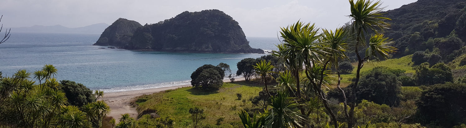
After the web conference, we made our way to Russell wharf. Here we boarded a water taxi. The taxi took us to Moturua Island – this is the location of Mangahāwea.
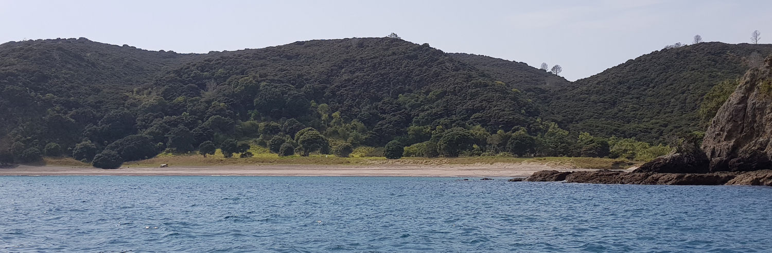
There was a bit of a swell coming into Mangahāwea Bay, so the skipper decided to drop us off on the other side of the island at a bay some call Frenchs Bay. It is known by this name because French explorer Marion Du Fresne and his crew set up temporary camp here for three months, three years after Captain Cook anchored off the island in 1769. The actual name of the bays where the camp was set up are Wai-iti and Waipao Bay.
We couldn’t step straight onto the beach, so we had to take our shoes off and wade through shin deep water. As we were doing so, the skipper pointed out about 6 stingrays sunning themselves in the shallow water. I made sure I looked where I was stepping!
History on my doorstep
After drying our feet and putting our shoes back on, we began the 15-minute walk over to the other side of Moturua. The island is pest free and immediately I could hear the song of a saddleback/tīeke. On the way I could even see probe holes where North Island brown kiwi had been searching for food.
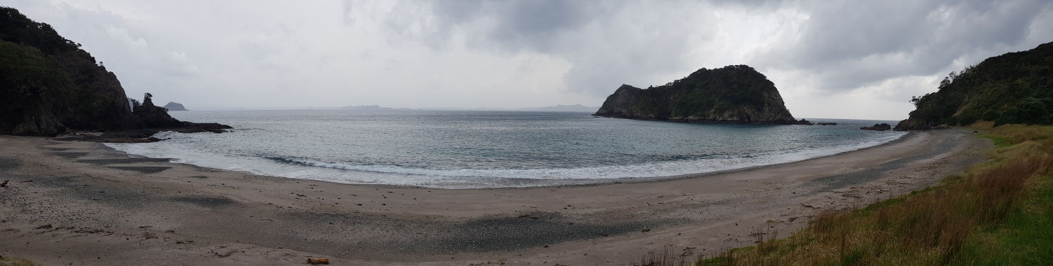
The track was steep and slippery, and I was glad when we reached the top of the track and began our descent. Soon, Mangahāwea Bay came into view. And what a magnificent view it was, as you can see from one of today’s images. I took a moment to take in the scenery and consider the importance of this site. I didn’t learn any New Zealand pre-European history when I was at school, and I felt lucky to be in a place of such historical significance so close to where I live in Kerikeri. This was one of the first places in Aotearoa where the ancestors of modern Māori settled after their long journey from Polynesia about 700 years ago. Take some time to think about that…
Reading history through layers in the earth
We spent the next hour with archaeologist Andrew Blanshard. Andrew was part of the most recent excavation team, so he knows the area well. He took us to the spot where in the late 1970s, a member of the public first spotted part of what turned out to be a large hāngi pit. It was from this discovery that the first excavation in the early 1980s took place.
The size of the hāngi pit showed that this area supported a large population. Further excavations uncovered kūmara storage pits, gardens, and a range of artefacts including shell, bone, and stone tools.
Interestingly, archaeologists have found bones of moa and a large limpet shell at Mangahāwea. Both moa and this large limpet died out within 200 years of human arrival, so anyone eating these animals must have been among the first people to arrive in Aotearoa.
As I listened to Andrew, I began to get a picture in my mind of how the village would have looked all that time ago. Waka pulled up onto the beach; the smoke from cooking fires drifting on the sea breeze; fish from the day’s catch drying on racks; people working in gardens and making and mending their tools; thatched whare set back further from the beach. You can see artist Krystal Wolfe’s impression of what the village may have looked like in today’s images.
A day of rich history
It was soon time to leave Mangahāwea. We walked back over the hill to where our water taxi was waiting to take us back to Russell wharf. The afternoon sea breeze was creating a chop on the water. I copped a bit of sea spray on my face on the way back, but I found it enjoyable. The 225 horsepower Yamaha four-stroke made short work of the trip back, and before we knew it, we were back at Russell/Kororāreka.
I felt richer from the day’s experience. It has sparked in me a desire to learn more about the history here in Te Pēwhairangi/Bay of Islands. And we will do just that tomorrow when we find out about the first interactions between Māori and Europeans when Captain Cook and his crew sailed into the Bay in 1769. I’m looking forward to it!
Make sure you check out today’s videos where I talk more with Andrew about what the archaeological excavations have uncovered about early human occupation on Mangahāwea.
Mā te wā and catch you tomorrow,
Andrew

Russell Museum/Te Whare Taonga o Kororāreka, the location for this morning's web conference. Image: Andrew Penny, LEARNZ.

Andrew and the ambassadors with Andrew Blanshard on this morning's web conference. Image: Shelley Hersey, LEARNZ.

On the water taxi during the journey to Mangahāwea. Image: Shelley Hersey, LEARNZ.

Dave the skipper who took us to Mangahāwea. Image: Andrew Penny, LEARNZ.

Looking into Mangahāwea Bay from the boat. The swell was up a bit so we ended up getting dropped off on the other side of the island. Image: Andrew Penny, LEARNZ.

The water taxi leaves "Frenchs Bay". Behind it is the R Tucker Thompson, the ship you'll be sailing on tomorrow. Image: Andrew Penny, LEARNZ.

Some traps and tracking tunnels on the track over to Mangahāwea. These help keep the island pest free. Imge: Andrew Penny, LEARNZ.

Our first view of Mangahāwea. Compare this image with the artist impression of what the village may have looked like. Image: Andrew Penny, LEARNZ.

An artist's impression of what an early Māori village may have looked like at Mangahāwea based on evidence from archaeological excavations. Image: Krystal Wolfe.

Andrew Blanshard from DOC points out part of the large large hāngi pit that was first discovered in the late 1970s. Image: Andrew Penny, LEARNZ.