

Natural Hazards
Learning from the past to prepare for the future
About this field trip
Join us on a LEARNZ virtual field trip to Te Moana-a-Toitehuatahi | Bay of Plenty, one of the most geologically active areas in Aotearoa New Zealand. This region is shaped by fault lines, volcanoes, and the ever-shifting tectonic plates beneath our feet.
On this journey, you'll uncover the science behind natural hazards and learn how past events help us prepare for future emergencies.
Travel to sites affected by earthquakes, floods, landslides, tsunami, and volcanic eruptions. You’ll meet experts, hear real stories, and discover how science, technology, and past experiences are helping communities become more resilient in the face of emergencies.
Objectives
The objectives of this virtual field trip are to:
increase awareness and understanding of Earth’s dynamic systems and natural hazard processes
highlight the impacts of natural disasters and how they affect people and infrastructure
equip participants with the knowledge and skills to prepare for and respond to emergencies.
Key learning
Through this field trip, participants will:
explore a range of natural hazards including:
volcanic eruptions
landslides and debris flows
earthquakes and flooding
tsunami hazards and their impacts
understand what causes these hazards and how they affect communities
learn how scientists and emergency managers study and respond to hazard events
discover how to prepare for life without power, water, communication, or access to your home during an emergency
gain confidence in what to do during an emergency and how to look after yourself and others.
Student-led inquiry
Empower your ākonga to take charge of their learning journey. Encourage them to ask meaningful questions, explore resources, and embark on their own journey of natural hazard preparedness.
Curriculum alignment
This virtual field trip aligns with The New Zealand Curriculum refresh (2022). It covers a range of learning areas, predominantly science and social sciences. Access guidance that supports teaching and learning to align with curriculum goals.
Educator guide
This guide is designed to support teachers in aligning the LEARNZ Natural hazards virtual field trip with the goals, structure, and learning outcomes of The New Zealand Curriculum refresh (2022). It outlines the key learning intentions, suggests cross-curricular links, and provides examples of teaching and learning opportunities that are meaningful, place-based, and action-oriented.
Learning areas and achievement objectives
The virtual field trip is designed to:
increase understanding of Earth’s dynamic systems and how natural hazards occur
explore the social and environmental impacts of natural disasters
develop ākonga knowledge and skills to prepare for and respond to emergencies
empower student-led inquiry and action.
Curriculum vision and values
This field trip supports the vision of The New Zealand Curriculum refresh (2022) by helping ākonga to:
contribute confidently to communities that are informed and prepared
value the whenua, understanding place-based risks and histories
respect multiple knowledge systems, including mātauranga Māori and science
act with care and responsibility toward themselves, others, and their environment.
-
Strands: Place and environment; Continuity and change; Identity, culture, and organisation
Achievement objectives:
Level 2
Time and change affect people’s lives.
Places influence people and people influence places.
Level 3
People view and use places differently.
Level 4
Understand that events have causes and effects.
Formal and informal groups make decisions that impact communities.
People participate individually and collectively in response to community challenges.
Learning activities:
Create a hazard impact map of Aotearoa.
Compare Māori and non-Māori responses to historical natural disasters.
Interview whānau members about past disasters and community responses.
Develop a class inquiry into local hazard risks and Civil Defence plans.
-
Strand: Nature of science
Achievement aims:
Participating and contributing
Levels 1–2: Explore and act on issues and questions that link their science learning to their daily living.
Levels 3–4: Use their growing science knowledge when considering issues of concern to them.Investigating in science
Levels 1–2: Extend their experiences and personal explanations of the natural world through exploration, play, asking questions, and discussing simple models.
Levels 3–4: Ask questions, find evidence, explore simple models, and carry out appropriate investigations to develop simple explanations.
Strand: Planet Earth and beyond
Earth systems
Levels 2–3: Appreciate that water, air, rocks and soil, and life forms make up our planet and recognise that these are also Earth’s resources.
Learning activities:
Investigate how tectonic plates cause earthquakes and volcanoes.
Compare scientific tools used to monitor hazard risks.
Conduct simple models (for example, earthquake shake tables or erosion simulations).
Analyse video interviews with scientists to understand risk prediction.
-
Understand: Literature, language, and texts express, influence, and explore perspectives and ideas | Kei ngā mātātuhi, kei te reo, kei ngā tuhinga hoki te whakaahuatanga o te mana tangata, mana rōpū
Know: Ideas within, across, and beyond texts | Ngā aria
Do: Comprehending and creating texts | Te whakamahi rautaki ki te whai māramatanga
Learning activities:
Write a news article or report on a natural hazard event.
Present a video journal from the perspective of someone affected by a disaster.
Design infographics or public service announcements about being prepared.
-
Strand: Personal health and physical development
Students develop the knowledge, understandings, skills, and attitudes that they need in order to maintain and enhance their personal wellbeing and physical development.
A3 Safety management
L2: Identify risk and use safe practices in a range of contexts.
L3: Identify risks and their causes and describe safe practices to manage these.
L4: Access and use information to make and action safe choices in a range of contexts.
L5: Investigate and practise safety procedures and strategies to manage risk situations.
Strand: Healthy communities and environments
Students contribute to healthy communities and environments by taking responsible and critical action.
D1 Societal attitudes and values
L2: Explore how people’s attitudes, values, and actions contribute to healthy physical and social environments.
L3: Identify how health care and physical activity practices are influenced by community and environmental factors.
Learning activities:
Plan and practise school emergency drills.
Create personal or whānau emergency kits and plans.
Reflect on how to stay calm and help others during emergencies.
Role-play scenarios involving risk and decision-making.
-
Focus concepts: Whakapapa o te whenua, kaitiakitanga, mātauranga ā-iwi
Learning outcomes:
Understand Māori perspectives on the land, signs of natural change, and ancestral stories.
Learn how iwi and hapū prepare for and respond to natural hazards.
Learning activities:
Explore local pūrākau about natural events or landmarks.
Compare local iwi knowledge with scientific predictions.
Create a visual story (poster, animation, or mural) of how mātauranga Māori informs hazard awareness.

Discover more
Select a topic, image or Read more link for background information, images, narrations, and kupu Māori | keywords for each topic.

Preparing for the future
If a natural hazard like an earthquake or flood damages your house, fixing it can cost a lot of money. That’s why paying for an insurance policy is so important – it helps pay to fix things up!
Landslides – Ngā horo whenua
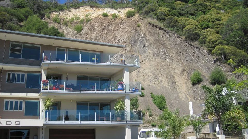
A landslide happens when rock, soil, and debris suddenly move down a slope. They can be small, like a single falling rock, or huge, covering many kilometres with tons of earth. Landslides are a serious hazard in many parts of Aotearoa New Zealand.
Earthquakes & tsunami – Ngā rū whenua me ngā tai āniwhaniwha
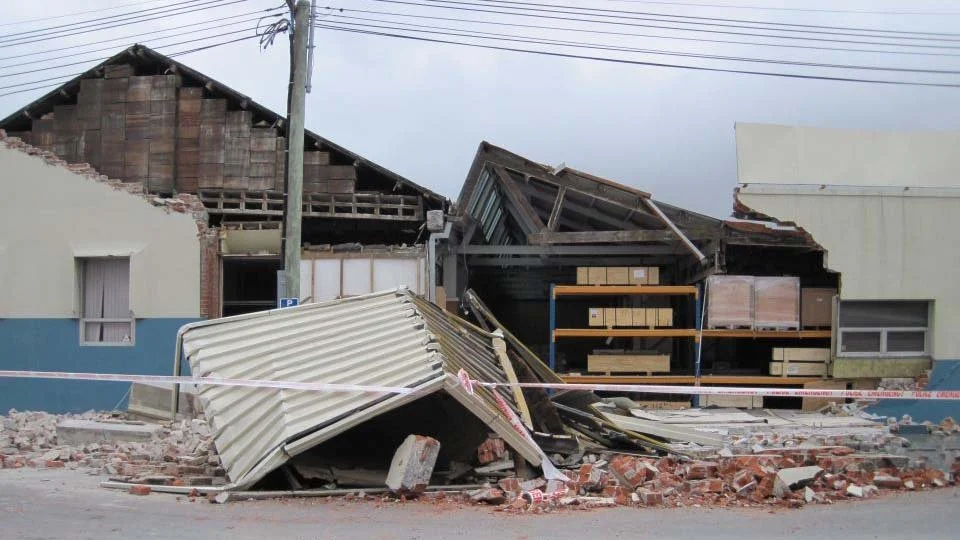
Earthquakes happen every day in Aotearoa New Zealand, but most are too small or far away to be felt. Our country sits on the boundary between two huge tectonic plates – the Pacific and Australian plates – that are always moving and sometimes cause the ground to shake.
Volcanic activity – Hūnga
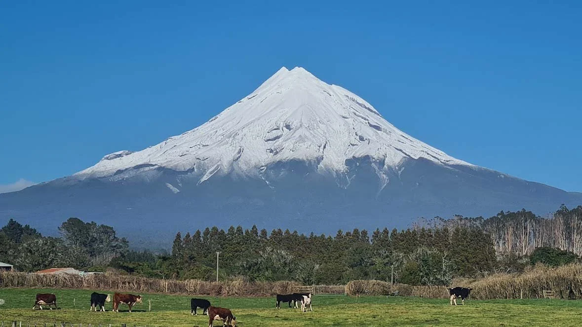
A volcano is a landform that forms when magma (hot, melted rock) from beneath the Earth’s surface erupts. New Zealand is part of the Ring of Fire – a circle of volcanoes around the Pacific Ocean where many eruptions happen.
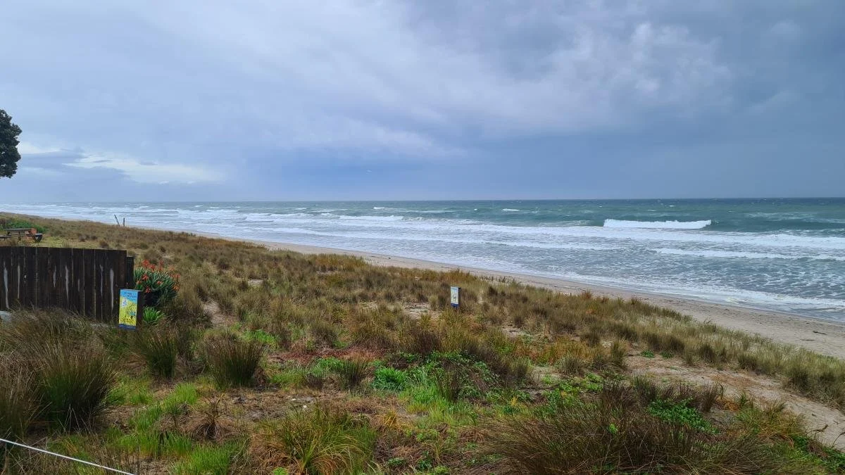
Storms & floods – Ngā āwhā me ngā waipuke
Storms can happen any time of the year in Aotearoa New Zealand. They bring heavy rain, hail, lightning, strong winds, and sometimes tornadoes. Storms can also cause flooding, landslides, and even snow in some areas.
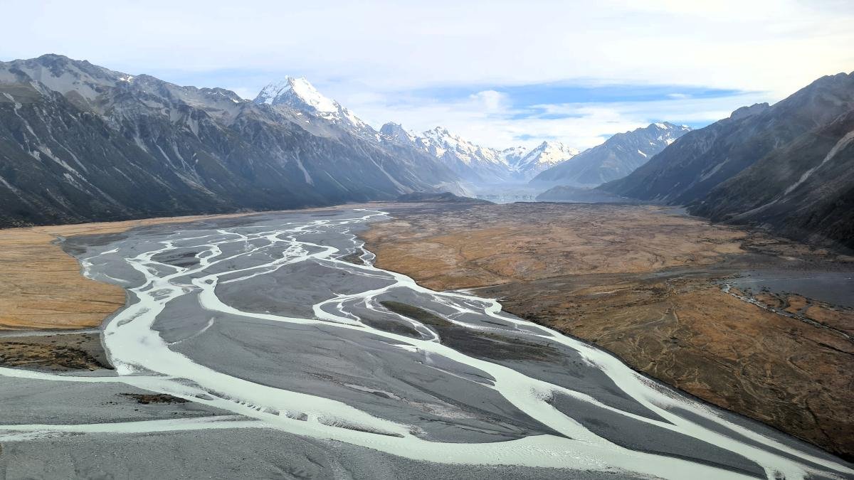
Natural hazards in Aotearoa New Zealand
Aotearoa New Zealand is one of the most geologically active countries in the world. Our landscapes have been shaped by powerful forces over millions of years. Sometimes these forces can create natural hazards – events that have the potential to cause harm to people, property, and the environment.
Connect with field trip experts
Meet Tane
Tane is part of the emergency management team at Tauranga City Council.
Meet Craig
Craig is a volcano geophysicist at Earth Sciences New Zealand (formerly GNS Science).
Meet Graham
Graham is a volcanologist and lead scientist for hazards and risk at Earth Sciences New Zealand (formerly GNS Science).
Explore the field trip videos
Join our field trip experts as we visit new places and learn new things
Tsunami hazards: know the signs, stay safe
On the beach at Ōmanu Bay near Mount Maunganui, we find out what a tsunami is, how it’s caused, and the warning signs to watch for. We also learn the simple safety rule: if it’s long and strong, get gone – move quickly to higher ground or inland to stay safe.
What natural events can cause a tsunami?
What does “long and strong” mean when talking about earthquakes and tsunami warnings?
Where should you go if you’re at the beach and there’s a tsunami risk?
Grab bags and smart planning: preparing for hazard impacts
Watch and discover how to get ready for emergencies – whether you’re stuck at home or need to leave quickly. From stocking up on food, water, and essentials, to making a personalised “grab-and-go” bag, it’s all about having a plan that works for you and your whānau.
What are some essential items to keep at home in case you are cut off for several days?
What might you include in a grab-and-go bag, and why could yours be different from someone else’s?
Why is it important to have different emergency plans for home, school, work, and travel?
Volcano monitoring, impacts, and preparedness
At Kōhī Point in Whakatāne, we talk with volcano geophysicist Craig about how volcanoes can affect people, animals, and travel – even from far away. Craig explains what causes ashfall, how scientists monitor volcanoes, and the simple steps people can take to stay safe if one erupts.
How can ash from a volcano affect homes, farms, and water supplies?
What tools do scientists use to monitor volcanoes and warn people of danger?
What are some easy ways people can protect themselves and their property from volcanic ash?
Shaken earth: faults, quakes, and readiness
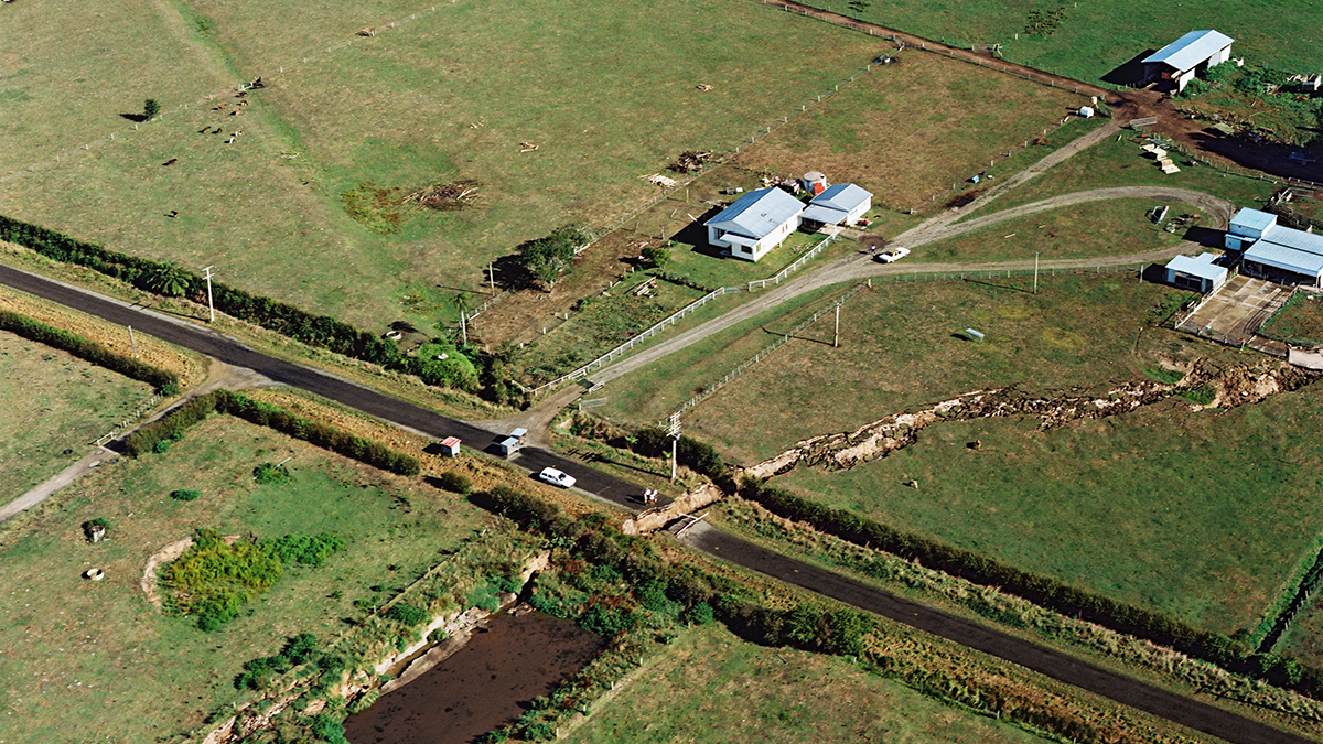
Visit Edgecumbe to see where a powerful 1987 earthquake caused the ground to suddenly drop by two metres. We learn how earthquakes shape the land, how they can lead to flooding risks, and what people can do to reduce damage and stay safe in future events.
What happened to the land in Edgecumbe during the 1987 earthquake, and what damage did it cause?
How can earthquakes increase the risk of flooding in some areas?
What building and location choices can help reduce earthquake hazards?
Know your slope: understanding landslides
In this video, we visit Matatā in the Bay of Plenty. Find out why landslides are one of the most damaging hazards, what causes them, and how insurance can help people recover after a disaster.
Why are landslides considered one of the most damaging natural hazards in New Zealand?
What natural events can trigger a landslide, and how can they sometimes combine to make the problem worse?
How does insurance help people recover from natural disasters like landslides?
Take the Google Earth tour
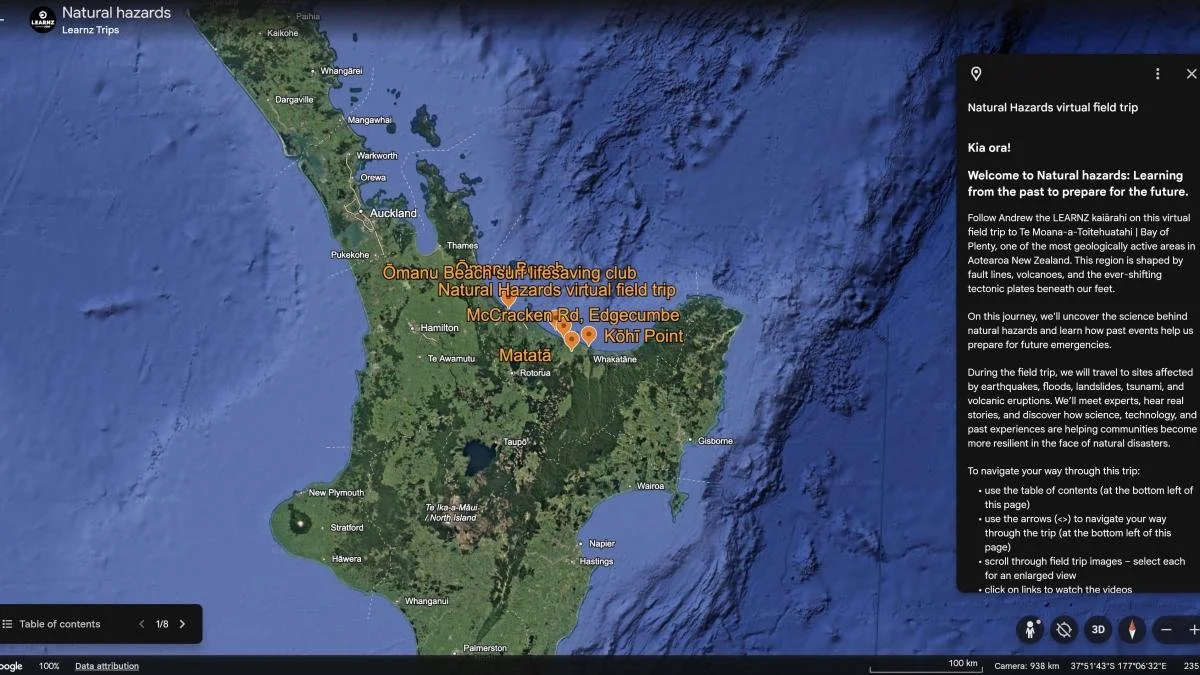
Take the Google Earth for Web Tour
A virtual tour of the field trip with GIS mapping, 3D locations, 360° panoramic images, videos, and further information.
Web conference
Replay the field trip web conference
Resources
Useful links and resources
NHC Toka Tū Ake | Museum and schools programme
Part of EQC's outreach work is to help raise hazard-aware Kiwis and support the understanding of natural forces that have shaped the land.
NHC | Natural hazards portal
Find out about natural hazard risk in Aotearoa New Zealand, and see how previous events have impacted a property by looking at past Natural Hazards Commission claims.
GNS Science Te Pū Ao | Natural hazards and risks | Ngā Matepā me ngā Tūraru ā Taiao
GNS Science has a national leadership role in monitoring and researching the causes, risks and consequences of geological hazards in Aotearoa New Zealand.
GeoNet
Check recent earthquake and volcano alert levels, as well as the date, time, and location of the latest earthquake.
Get Ready
Learn more about natural hazards in Aotearoa and how to prepare.
What's the Plan Stan?
A free resource to support schools, teachers and students to develop the knowledge and skills to prepare for emergency events.
New Zealand disasters
With thanks to Christchurch City Libraries:
Cyclones and floods
Kopuawhara floods (Mahia Peninsula, 1938)
Cyclone Giselle (New Zealand wide, 1968)
Southland floods (1984)
Cyclone Bola (East Coast, North Island, 1988)
Earthquakes, landslides and volcanoes
Wellington earthquake (1855)
Mount Tarawera eruption (1886)
Murchison earthquake (West Coast, South Island, 1929)
Hawke's Bay earthquake (1931)
Inangahua earthquake (West Coast, South Island, 1968)
Abbotsford landslide (Dunedin, 1979)
Edgecombe earthquake (Bay of Plenty, 1987)
Museum of New Zealand Te Papa Tongarewa | Images of natural disasters (Please check individual photos for reuse information.)
School Journal resources
Idea City (PDF)
Earthquake (PDF)
Quake, Rattle and Roll (PDF)
Low Tide (PDF)
The Big Dig (PDF)
Glossary
Australian Plate – One of the giant tectonic plates that makes up the Earth’s surface. It meets the Pacific Plate under New Zealand, causing earthquakes, volcanoes, and mountains to form.
Caldera – A huge, bowl-shaped hole in the ground formed when a volcano erupts and its top collapses.
Civil Defence Emergency Management (CDEM) – Groups in different regions of New Zealand that help communities prepare for, respond to, and recover from emergencies.
Cone Volcano – A volcano with steep sides, built up from layers of lava and ash.
Cyclone – A large, spinning storm that forms over warm tropical seas. It can bring strong winds, heavy rain, and flooding.
Emergency plan – A plan made with your family about what to do, where to go, and what to take during an emergency.
Emergency supplies (Grab bag) – A bag of important items like water, food, a torch, and first aid that you can take with you if you must leave home quickly.
Earthquake – Sudden shaking of the ground caused by movement along cracks in the Earth’s crust called faults.
Fault – A crack in the Earth’s crust where movement can cause earthquakes.
Flood – When water covers land that’s usually dry, often caused by heavy rain, storms, or overflowing rivers.
Landslide – When rocks, soil, and debris suddenly move down a slope, often caused by heavy rain, earthquakes, or unstable land.
Long or Strong, Get Gone – A safety rule for tsunamis: if an earthquake is long or very strong, first drop, cover, hold, and then move quickly to higher ground.
Magnitude – A measure of how strong an earthquake is. Higher numbers mean more powerful quakes.
Magma – Hot, melted rock found beneath the Earth’s surface.
Mātauranga Māori – Māori knowledge, wisdom, and understanding, passed down through generations.
MetService – New Zealand’s official weather service that provides forecasts and severe weather warnings.
Natural hazard – An event in nature that can harm people, property, or the environment, such as an earthquake, flood, or volcanic eruption.
Natural Hazards Commission Toka Tū Ake (NHC) – A government organisation that helps insured homeowners repair damage from natural hazards and funds research to keep communities safer.
Pacific Plate – One of the giant tectonic plates that meets the Australian Plate under New Zealand, causing earthquakes and volcanic activity.
Ring of Fire – A zone around the Pacific Ocean where many earthquakes and volcanoes occur.
Roaring forties – Strong winds found between 40° and 50° south of the equator, which affect New Zealand’s weather.
Storm surge – Extra-high waves and flooding along coasts caused by strong winds and low air pressure during storms.
Tectonic plates – Massive slabs of rock that make up the Earth’s surface. They move slowly, and where they meet, they can cause earthquakes, volcanoes, and mountain building.
Tsunami – A large and powerful wave or series of waves caused by an underwater earthquake, volcano, landslide, or meteorite.
Volcanic ash – Tiny pieces of rock blasted into the air during a volcanic eruption that can travel long distances and cause damage.
Volcanic field – An area with many small volcanoes, craters, and cones spread over the land.
Volcanic unrest – When a volcano shows signs of activity, such as rumbling or releasing gas, but hasn’t erupted.
Volcano – A mountain or hill made when magma from inside the Earth erupts onto the surface as lava, ash, and gas.