Why this field trip?
In 2017 we visited Ruatoria, and in 2018 Taranaki. At these places we learned about some environmental and Iwi themes. This year’s field trip will enable all of you to enquire about your own culture and heritage. You will find out how to use rich mapping tools to represent your place in the world – your waahi.
The field trip may also lead to an appreciation of the wider world beyond your current geographical “sphere” of awareness. Sharing and discovering each other’s stories can help with understanding the connected cultures and heritages you might have with your fellow students.
Project Overview
In early 2019, field trip expert Duane Wilkins worked with four classes at Belmont School in Lower Hutt. He created a real-life project to base this field trip on.
The teachers at Belmont School developed and sent home an initial brief for parents. This included a template to help students gather information about their ancestry, heritage, or places that are important to them. They were encouraged to talk with their parents and family about where they come from and add images and stories to describe their family history.

- Here is an example and blank template.
Google Earth
Duane introduced the class of students to Google Earth, using a game called “Where on Earth is Carmen Sandiego?” based on a famous 1985 geography quiz game.

The students explored Google Earth to learn how to search and explore using maps. This included using street view 360 imagery, photos, addresses, roads, and satellite imagery in an easy to use 3D application. Teachers added this site to the Student Bookmarks in their ChromeBooks.
Students enjoyed the 360 “Streetview” imagery, enabling them to virtually walk down streets they know. They were also able to view immersive stories from all over the world using the “Voyager” collection of curated stories.
- Access Google Earth online https://www.google.com/earth/
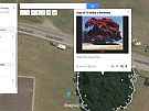
Tourbuilder
Students then used a tool called Tourbuilder. Tourbuilder is a free, easy-to-use, private mapping tool. You use a simple template to develop a linear story where the focus is on content, not formatting. Students use their classroom Google login and add several key places like slides in a PowerPoint.

- Access Tourbuilder online: https://tourbuilder.withgoogle.com/
- Tutorial for Using Tourbuilder
Privacy
Google tools work well for students. Teachers can control privacy, templates and access. You do not need information such as a student’s address or other personal details.
- No student information appears, nor will ever appear, in Google Maps.
- This project uses the same security methods employed within a School's Educational Suite. Access and privacy are limited to the teacher, students and their parents.
- The stories are not intended to be made public.