You can contact LEARNZ, part of CORE Education, at:
Postal Address:
PO Box 13 678,
Christchurch 8141,
New Zealand
GIS Officer at the Mackenzie District Council.
I am looking after our council’s mapped data and map applications and I am making sure these are up to date and up to standard. Quite regularly I also capture new data either using field equipment such as GPS or by digitising on screen in the office. But the most challenging part of my job really is finding solutions to “geospatial problems” that people within and outside my organisation might have. Sometimes the solution might be a map, other times it might be a flow chart, a spreadsheet, a report, a 3D model or a web map application.
I grew up, studied and graduated in Eastern Germany and gained my first work experience at a research institute in Germany doing some GIS work in flood protection research.
I later moved to Australia and one of my jobs was to model bushfire hazard for North Queensland, an area almost exactly the size of Germany. I learned about fire behaviour, conditions that effect fire severity and flammability of the plants in North Queensland. I also had the opportunity to train up as a volunteer fire fighter and got to experience bush fires first hand, which helped my modelling.
In New Zealand I had a 3-year stint into the surveying industry in Wanaka and learned about the joys and struggles of surveying equipment and data accuracy – an answer to a question not always asked: How was the data captured and what were the constraints?
At Wellington City Council one of my most interesting projects was to setup a GIS Emergency Management Strategy for our Wellington Region Emergency Management Office. This included having data (offline and online), staff and procedures in place that would allow a quick, stream-lined GIS response in the event of a natural disaster. The Christchurch earthquakes had taught us some valuable lessons that gave us a few things to think about and improve.
I do like looking at what makes our world go round. This part of GIS is called GIS analysis or GIS modelling - looking at the components that form our environment and the impacts that can change this environment. The mapping of the results is the real fun part of it and can reveal a few surprises. I have always been interested in maps - I think they are a great way of explaining our complex world to others.
When work gets monotonous and repetitive.
At the moment I spend quite some time taking our baby daughter out on walks and bike rides, or sometimes we would just go and explore the gardens and local play grounds. And when she is older she might just like to try those other sports like skiing, kayaking, mountaineering and rock climbing that I love doing when there is time for it.
Watch the video where Jana talks about her work (35 Mb mp4 file).

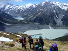
Meet Jana Kaeppler a GIS Officer at Mackenzie District Council. Image: J Kaeppler collection.