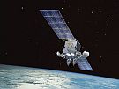
What is SBAS
SBAS uses satellites as well as ground stations to improve the accuracy, speed and access to basic satellite navigation signals, like GPS. New Zealand and Australia are working together on a trial of a satellite navigation system known as SBAS - satellite-based augmentation system.
Where is SBAS used?
SBAS is already in use in the United States, Europe, Japan and India. While New Zealand and Australia have good access to GPS, we do not yet have access to SBAS.
Benefits of SBAS
This system will make satellite navigation systems like GPS even more accurate and reliable than they are now. It allows errors to be found in these systems, so they can be adjusted to be more precise for New Zealand. This will make them more useful for:
- transport systems like self-driving cars
- unmanned aerial deliveries
- farming, forestry
- smart phone-based services.
In the future, SBAS could be used for air navigation. It could help aircraft to land in worse weather at regional airports and heliports without the need for costly landing aids on the ground.
SBAS could also be used to help improve road safety and manage traffic.
Trialling SBAS
This technology will be trialled in both countries in 2017 and 2018. The governments of New Zealand and Australia are working together on this trial. It will improve the accuracy of GPS and other satellite navigation systems, so accurate location information can be received anytime and anywhere across New Zealand.
 The trial programme will look at the uses and benefits of SBAS. The results will be used to help decide whether New Zealand should develop SBAS for everyone to use.