Date:
Wednesday, May 23, 2018


You can contact LEARNZ, part of CORE Education, at:
Postal Address:
PO Box 13 678,
Christchurch 8141,
New Zealand
Kia ora koutou,
It was bitterly cold in Invercargill this morning. Fresh snow coated the hills and dark storm clouds loomed on the horizon. The stormy weather made the journey out to Awarua Satellite Ground Station that much more interesting. You had to drive carefully on the gravel roads to avoid massive puddles and pools of mud.
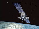
Robin McNeil is the ‘Dishmaster’ at the Awarua Station and he had promised to show you around. Before a tour of the site, you connected with Ohaeawai School and Adventure School during the web conference. Students asked lots of questions about satellites. It was amazing to hear that satellites can be as small as 10cm. GPS technology relies on satellites, but GPS doesn’t work if the signal cannot reach a receiver on the ground. Robin explained that satellite ground stations like Awarua can track satellites and receive information from them – they are like a phone that answers the call that satellites send out. Without ground stations we could not monitor things in space or receive information from satellites. You can find out more by listening to a recording of the web conference and watching the video.
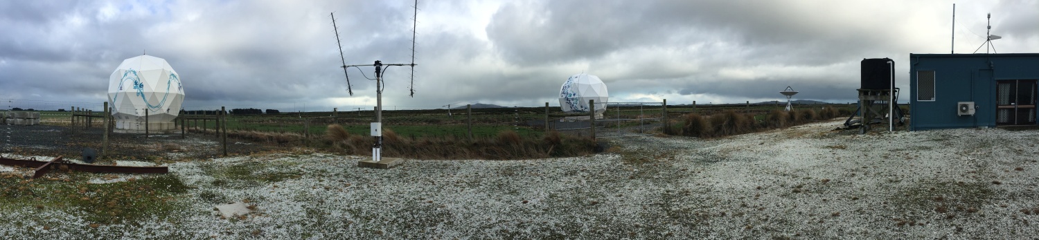
Looking around the ground station it was incredible to think about what this equipment does. You could see a huge satellite dish and the domes that have been built to protect the more fragile satellite dishes from the weather. This equipment has helped New Zealand's Rocket Lab launch rockets into space from Mahia Peninsula. It’s fantastic to see what a small country like New Zealand can achieve in space technology. Awarua seems like an unlikely place for such specialised equipment but it is the perfect place for a ground station. Awarua sits at 47 degrees south and can monitor satellites over a large area where there are no other ground stations. The flat land around the station also gives a clear view of space. Watch the video to find out more.
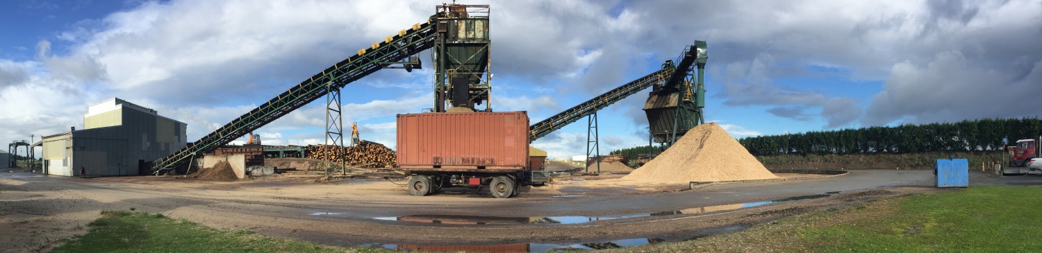
Robin talked to you about how the Awarua Station is involved in trialling SBAS navigation technology. More accurate GPS signals can help many industries. Here in Southland, forestry is an important industry. Robin introduced you to Shaun Foster who works for Southwood Export. He already relies on GPS to locate individual trees and plan forest roads but with SBAS this work will be much easier. Shaun took you to the Southwood chip mill where they turn mainly eucalyptus trees into chip, which is exported to places like Japan to be made into high quality paper products. It was surprising to hear that industries like this also rely on accurate location-based information. Watch the video about this.
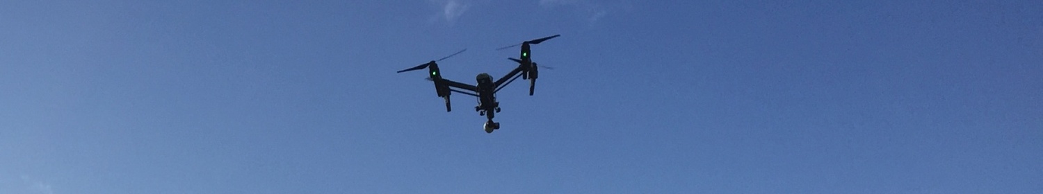
Drones are another type of technology that relies on accurate GPS signals. Verdon College is a local school where students have been learning about drones. David Irvine is a drone pilot and he brought a drone to show the students. Thankfully the weather cleared enough to allow him to launch the drone. Some drones can reach speeds of up to 60 kilometres per hour and travel distances of more than 5 kilometres. But there are strict rules about the use of drones to keep everyone safe, including people on planes! David had to get permission from the airport before flying the drone today. Drones can be used to take aerial photos, map things and even monitor the spread of weeds such as wilding pines. Drones are a lot cheaper to use than helicopters or planes and still look like a lot of fun to use. You can find out more by watching the videos.
To find out more about how wilding pines are monitored you talked to Helen Payn and Randall Milne at Environment Southland. Wilding pines can quickly take over, destroying farmland and important habitat for native plants and animals. Drones are helping to locate where wilding pines are, so they can be removed. GIS computer programmes are also helping with the fight against pesky pines. Mapping trees and where activities such as spraying have occurred, helps experts to work together. An app is also being developed which people can add information to. In the future you will be able to help by taking photos of wilding pines with this app to add to a national database of wilding pines. It has been a very busy day looking at different types of technology.
You now must leave Invercargill and head north to Dunedin to complete your techy tour during TechWeek.
See you there,
Shelley the LEARNZ field trip teacher.

Shelley introduces Robin McNeil during today's web conference. Image: LEARNZ.

The Awarua Satellite Ground Station has equipment that links to satellites in space. Image: LEARNZ.

You can see a satellite dish to the left and another dish which is protected by a dome. Why do you think it needs this dome? Image: LEARNZ.

Robin is the dishmaster at Awarua Satellite Ground Station and he enjoyed showing Shelley and the ambassadors around the station. Image: LEARNZ.

You visited the Southwood Export chip mill where logs are turned into chip so they can be exported to make into paper products. How is satellite-based navigation used in this industry? Image: LEARNZ.

Students watch David controlling the drone with a remote control unit. Image: LEARNZ.

Students from Verdon College eagerly await the launch of a drone. What are drones used for? Image: LEARNZ.

David launches the drone above the school rugby field. Image: LEARNZ.

Randall, Shelley and Helen look at maps showing the spread of wilding pines. Why are wilding pines a problem? Image: LEARNZ.