Seismology
This was a complex earthquake. It included 12 major faults and at least nine lesser faults. The first rupture started on a fault near Waiau and Rotherham. Ruptures then jumped from fault to fault. The ruptures travelled 170 kilometres along the South Island’s north-east coast. Energy from the earthquake was released for nearly 2 minutes. Scientists recorded more than 16,000 aftershocks in the 6 months after the earthquake.
Damage
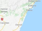
The earthquake caused a lot of damage which has disrupted the lives of many. There have been different effects for small rural communities compared to the larger towns like Kaikōura.
There were two deaths, and many people were injured. Luckily the earthquake struck when popular tourist destinations were empty at the time.
Homes were damaged, and some businesses closed. Farms were left with land damage and reduced access to markets for their goods (see Communities Adapting to Change). Farms in Hurunui had land damage from the earthquake on top of damage from years of drought. Communities lost trade from passing traffic and tourists.
State Highway 1 and the railway between Picton and Christchurch were badly damaged. Coastal uplift changed the coastline and the seafloor. Buildings in Wellington and Lower Hutt were also damaged. A number of these were demolished.
Tsunamis
Near Kaikōura there was a 2.5 metre drop in water level 25 minutes after the earthquake. This suggested a possible tsunami. The water level then rose about 4 metres from its lowest point. A series of waves continued for several hours.
In Little Pigeon Bay on Banks Peninsula, the tsunami wave flooded a cottage causing a large amount of damage.
Landslides
The earthquake produced more than 10,000 landslides. They caused major damage and disruption to a large area. Many debris dams were also created. Heavy rains and erosion over time caused many of the dams to break.
Geologically active area
Plate boundaries
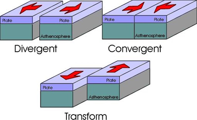
There are three types of tectonic plate boundaries. The movement of these plate boundaries cause different things to happen on the Earth’s surface.
- transform boundaries - where plates slide past each other.
- divergent boundaries - where two plates slide apart from each other.
- convergent boundaries - where plates slide towards each other.
The November 2016 earthquake occurred on the tectonic plate boundary between the Australian and Pacific plates. This area has created the Southern Alps and the Kaikōura Ranges.
The regions of Hurunui, Kaikōura and Marlborough get sideways movement and plates pushing up against each other. This makes it a very seismically active area.
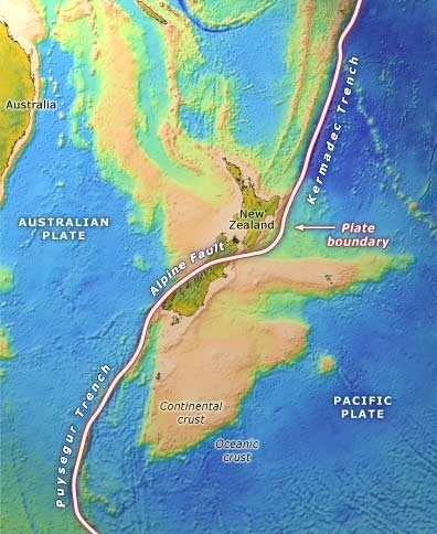
The two tectonic plates of the Australian and Pacific plates push past each other along the Alpine Fault. Image: GNS Science.
Moving the land in many directions
Ground shaking from this earthquake was the strongest ever recorded in New Zealand. Parts of the landscape changed a lot. GNS Science reports that the earthquake:
- pushed the rocky seabed up by as much as 6.5 metres
- moved the land from Kaikōura to Cape Campbell north-west and closer to the North Island
- raised some parts of the inland region by up to eight metres.