Wayfinding basics
Before the invention of the compass, sextant and clocks, or more recently, the Global Positioning System (GPS), Polynesians navigated their ocean voyages without instruments. Instead, clues about position, direction, and distance came from the stars, sun, and moon; from patterns in the ocean, including currents, ocean swells, and localized wave characteristics; from clouds, the wind, and even from wildlife. Navigators also kept a mental log of their progress, always maintaining a sense of the distance covered and the present location.
Downwind sailing
Most traditional navigators plan their routes using a technique known as downwind sailing. The strategy is to set a course to a point at a given latitude upwind of the target island. Then, when you reach the correct latitude, you turn and let the wind carry you to your destination.
Downwind sailing helps simplify the challenge of locating the target island. If you sail directly toward your target and somehow miss it, you may not know which way to turn. Was it to the left or right? But if you sail to a point to one side (that is, east or west) and upwind of your target, you can then turn downwind and trust that the island is in front of you.
Winds and currents
For a successful sailing voyage you need very good knowledge of wind patterns and ocean currents. A strong current can be friend or foe, helping to carry you where you want to go or rapidly carrying you off course. Winds and currents vary widely from place to place and from season to season, and storms often disrupt the typical patterns. A good navigator thinks carefully about the likely winds and currents at the time of a voyage.
More about winds, currents and latitudes here: http://www.exploratorium.edu/neverlost/#/navigation/basics/plan/winds
The star compass
Traditional Polynesian navigators position themselves mainly by the stars, using what's called a star compass. The ability to read the night sky is a great skill. A star compass is used to help memorise the rising and setting points of the brightest and most distinctive stars and planets to set direction.
Navigators steer their waka toward a star on the horizon. When that star rises too high in the sky or sets beneath the horizon, another is chosen, and so on through the night. Seven to 12 stars are enough for one night's navigation, and the moon and bright planets such as Kōpō (Venus) and Pareārau (Jupiter) are also useful.
Read more on the Te Aurere star compass: http://teaurere.org.nz/star_compass.htm | http://teaurere.org.nz/star_positions.htm
Sun and moon
Of course, stars aren't visible all the time. That's when the sun and moon can help. At daybreak, navigators note the position of the waka in relation to the rising sun. As the sun gets higher in the sky, they look to where it will set in the evening. At night, if clouds or fog pass in front of your guiding stars, the moon may still be visible and a good bearing marker when it is near the horizon.
Ocean swells
When skies are too overcast for navigators to use the sun, the moon, planets or stars, ocean swells can fill in as a rough guide to direction. An experienced navigator can sense the direction swells are coming from as they pass under the waka. If you note the direction from which the swells are coming at a time when the stars are visible, those same swells can guide you when the stars disappear.
In the Pacific, prevailing north and south-easterly trade winds push up swells that remain constant for long periods. Navigators keep their waka at the same angle to these swells. Sudden changes in waka motion indicates that it has changed course.
But swell patterns can and do shift, so a navigator can't rely on them all the time. When all else fails, and there's no way to keep a correct bearing, a good navigator 'heaves to'; that is, takes down the sail and waits until he or she can set the course again.
Nearing land
Traditional navigators use a range of signs that show they are close to land before they can actually see it. Clouds hanging over high islands, reflections of lagoons in the sky, plants washed out into the ocean after a storm on land, wave refraction patterns (swells ‘bouncing’ off islands alters their patterns), and birds coming out to fish during the day and then returning to their home island are all signs used to detect land.
Exploring waka may have followed migrating birds, as told in Māori tradition. The long-tailed cuckoo comes to New Zealand from tropical Polynesia in October, and shearwaters would have been observed flying south in September. People would have known that land lay in that direction, but not how far away it was.
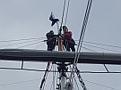
 Modern Navigation
Modern navigation relies on technology such as GPS, radar and digital charts but having some knowledge of traditional methods of navigation can still be helpful.