We are all located somewhere!
- We’re all located in a natural landscape eg with mountains, plains, rivers, coasts etc.
- We’re all located in a cultural landscape eg with man-made features such as schools, buildings, roads, towns, traditional knowledge, stories, leaders, events, sayings, and historical places.
The Ngāi Tahu Cultural Mapping Project
With the aid of GIS technology, the stories and place names that record Ngāi Tahu history in Te Waipounamu/the South Island are being mapped onto a virtual landscape. This is called the Ngāi Tahu Cultural Mapping Project.
What do we know about our kura/school and the cultural landscape it belongs to?
We can create our own map that shows our cultural landscape. Here are some ideas to get you started on a cultural map for your school community.
Possible Horopaki ako
- What topics for learning draw on natural features within the local environment eg sea, rivers, bush, mountains, bird?
Localised stories
- Identify significant hapū or iwi stories that have shaped the destiny of the haukāinga.
Landmarks
- Identify key geographical features significant to hapū/iwi.
- Identify sites of significance.
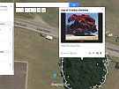
You could use this Google doc worksheet example to record information about nearby landmarks.
Tūpuna
- Who are the leaders, change agents, revolutionaries past and present that have lead, guided or modelled the hapū or iwi?
Marae/hapū, iwi
- Identify the marae, pā, significant hapū and iwi from the area.
Iwi/hapū events
- Identify significant events that impact on hapū/iwi celebrations both past and present.
Waiata
- List waiata tangi/mōteatea.
- Whakangahau, pao, haka significant to local hapū/iwi (iwi anthems).
Marae/hapū, iwi
- Identify the marae, pā, significant hapū and iwi from the area.
Reo
- Distinguish ‘reo’ that depicts the people through metaphors, kīwaha, whakataukī, whakatauākī, dialectual variations, geographical features.
Ako me aromatawai - learning and assessment
- Discern ways of learning or assessing that you think are preferable for your whānau, ākonga.
Ngā Tapuwae a ngā tūpuna - Ancestral footprints