Cartography
The word cartography comes from two Greek words meaning to write on paper:
- khartes meaning papyrus or paper.
- graphein meaning ‘to write’.
Before computers, cartographers drew maps with coloured pencils and rulers. Now with computers, anyone can be a cartographer! Here are three free tools you can use to make your own maps.
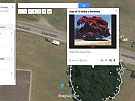
1. Google Earth
Google Earth is a free application that lets you fly anywhere on Earth to view satellite imagery.
You can use Google Earth to very quickly:
- in your browser, zoom in on an area you want to create a map of
- remove all the existing Google Earth symbols
- add your own border
- add your own symbols and place markers
- add your own border, scale and compass
- export your map into a useable image
- add your map to your project file eg MS Word etc.
Google My Maps is a free application that you can use to make your own maps and share them with others online.
Watch this video for simple instructions on how to create your map using Google Earth.
2. ZeeMaps
ZeeMaps is another free tool that allows you to create your own map.
You can use ZeeMaps to very quickly:
- in your browser, find your area on their map
- add coloured markers with descriptions, photos, videos
- insert your map into a web page
- set up password access to change your map.
Watch this video for simple instructions on how to create your map using ZeeMaps.
3. ArcGIS Online
As from April 2017, students in schools in America, Europe, Australia and New Zealand can now use ArcGIS Online (for free!) to explore and analyse data using maps. This is called the Esri Program for Schools. ESRI is a large American company that uses GIS mapping software to help people make their own maps. You can now use their smart software to make your own map for free!
You can use ArcGIS Online to very quickly:
- Find a location eg your school address, or a park
- Add data such as street names, regional boundaries, landmarks, parks, buildings, your own notes
- Obtain a web address (URL) for your map to share with others
- Embed your map into a website.