Imagine a river made of solid ice, so huge and heavy that it slowly slides down a mountain. That’s a glacier. Glaciers are like nature’s bulldozers. As they crawl downwards from the mountains towards the sea, they scrape, carve, and push everything in their path, completely changing how the land looks.
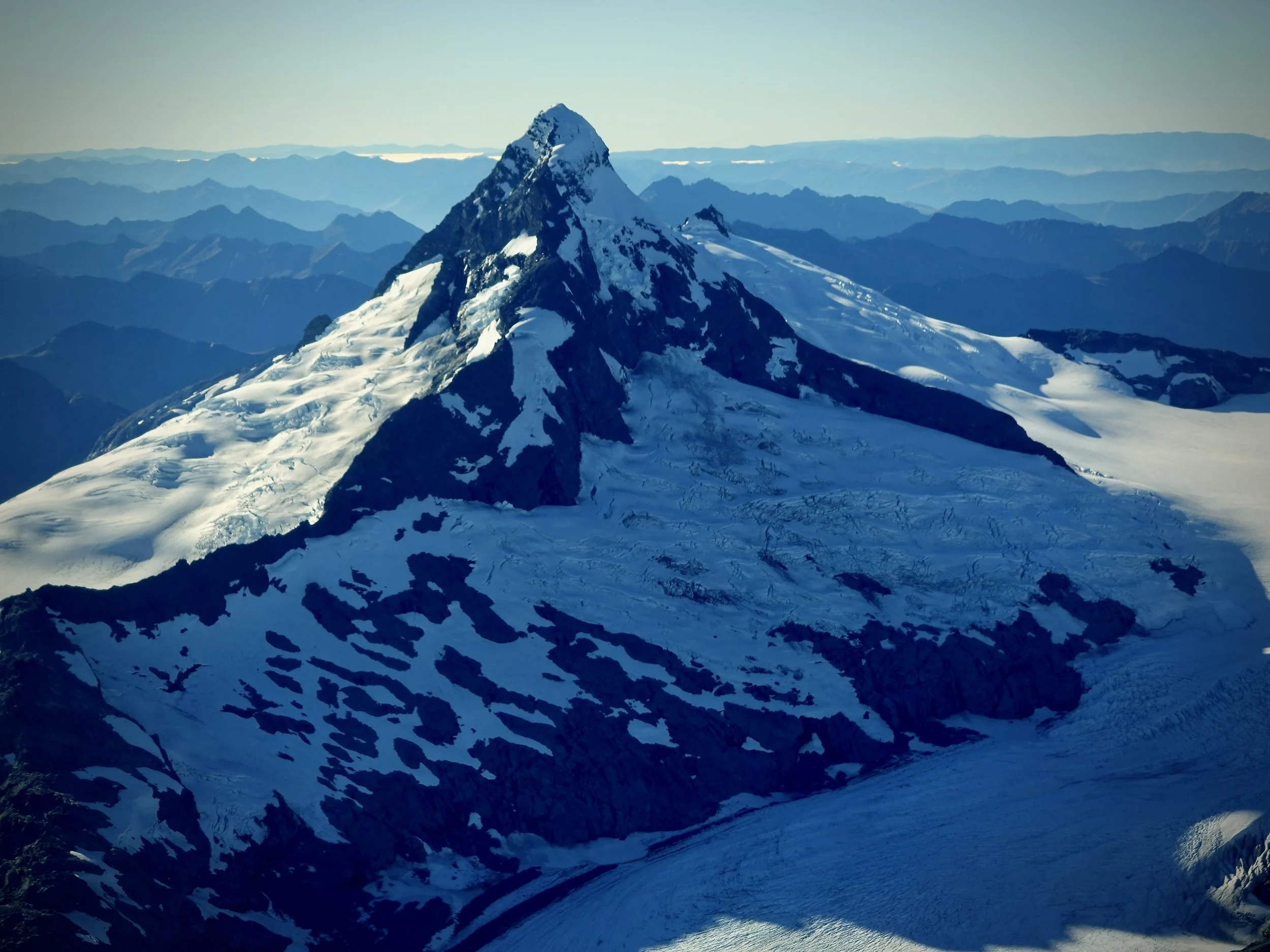
Tititea Mount Aspiring is a classic example of a glacial horn. Image: LEARNZ.
How ice shapes the mountains
When a heavy glacier slides downhill, it acts like giant sandpaper on the rocks below.
U-Shaped Valleys: Normal rivers carve out sharp "V" shapes, but a large, heavy glacier scoops out a wide "U" shape with steep sides and a flat bottom.
Hanging Valleys: Hanging Valleys are found high up on the sides of larger U-shaped valleys, formed by smaller glaciers.
Sharp Ridges (Arêtes): When two glaciers scrape down opposite sides of a mountain ridge, they leave behind a sharp, knife-like edge called an arête.
Cirques & Horns: Glaciers scoop out bowl-shaped hollows at the top of mountains called cirques. If multiple glaciers form around a single mountain peak, they sharpen it into a pointy pyramid called a horn or pyramidal peak. Tititea Mt Aspiring is a good example.
Fiords: Fiords are created by large glaciers that carve their way down to the sea. When the glacier melts back, seawater fills the deep, narrow valley.
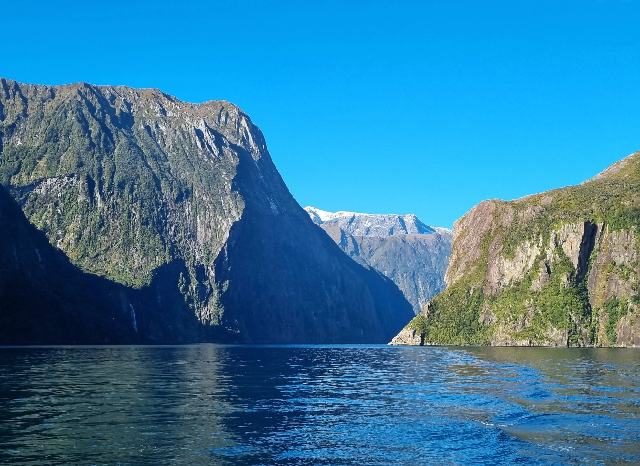
Piopiotahi Milford Sound is a fiord with steep valley walls carved by an ancient glacier. Image: LEARNZ.
In places with super hard rock, like Fiordland, these ice-carved landscapes still look sharp and dramatic today. Here you can see steep U-shaped valleys, hanging valleys and fiords. But in places like the Aoraki | Mount Cook region, softer rock erodes more easily, so old glacial shapes have been worn down into rock slides or scree and can be covered by river gravel.
How glaciers change our landscape:
1. Pre Glaciation
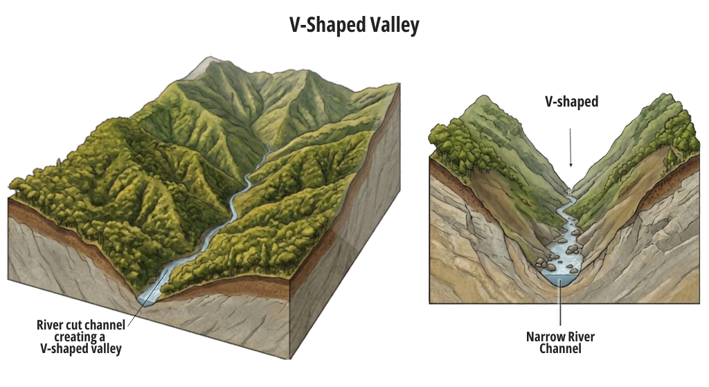
Image: LEARNZ.
2. Glaciation
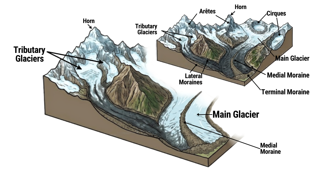
Image: LEARNZ.
3. Post Glaciation
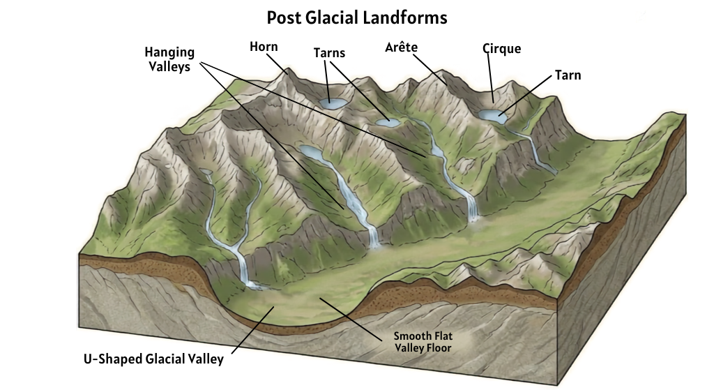
Image: LEARNZ.

A hanging valley above the glacially carved Lake Gunn in Te Rua o te Moko, Fiordland. Image: LEARNZ.
Spectacular glacier lakes
Te Waipounamu | the South Island has hundreds of lakes created by ancient glaciers. They range from tiny, puddle-sized mountain pools or tarns to the giant, 60-kilometre-long Lake Te Anau, which is over 400m deep.
These lakes are long and skinny, which is why they are called finger lakes. Giant glaciers dug these valleys deep, and they later filled with water.
Southland: Lakes Hauroko, Monowai, Manapōuri, and Te Anau
Otago: Lakes Wakatipu, Wānaka, and Hāwea
Canterbury: Ōhau, Pūkaki, Tekapo, and Coleridge
Nelson: Lakes Rotoiti and Rotoroa
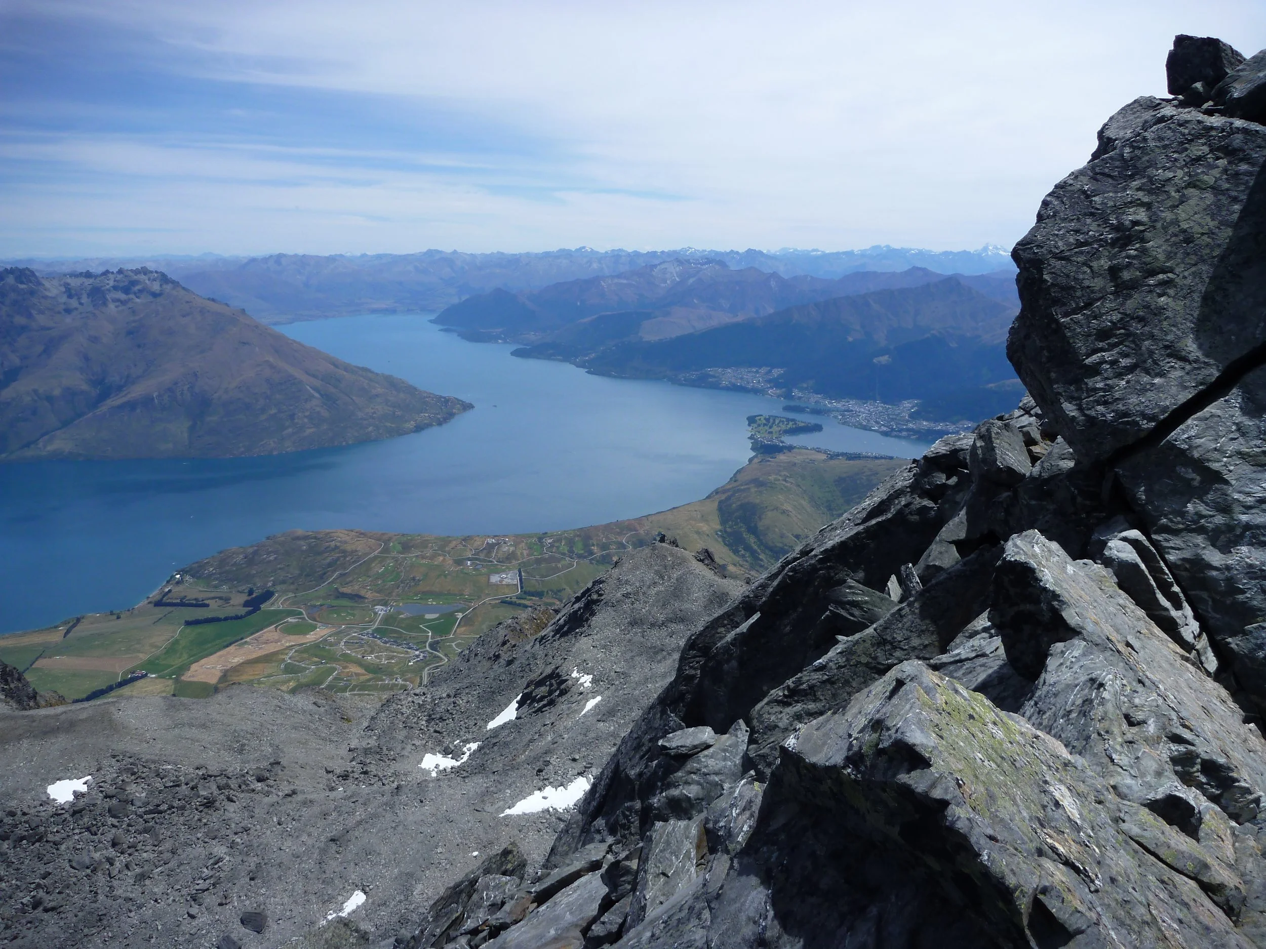
Waimāori Lake Wakatipu is an example of a glacier-carved finger lake. Image: LEARNZ.
Because the ice was so heavy, it dug these lakes incredibly deep—the bottoms of Lakes Manapōuri, Te Anau, and Wakatipu are actually below sea level.
What is moraine?
When a glacier melts, it leaves behind all the rocks, gravel, and dirt it carried and pushed forward. This pile of leftover glacier-trash is called moraine. It leaves behind huge ridges that show us exactly where the giant ice used to sit.
Flat areas like the Canterbury Plains formed when rushing rivers of melted glacier water washed tons of sand and gravel across the land.
Moraines are like the ring around a bathtub when you let the water out. New Zealand has beautiful moraines that show where the ice reached and how big it was in the past. You can find out more in the Earth Sciences video Why are scientists worried about New Zealand glaciers collapsing.
Rock flour – the secret ingredient in glacial meltwater
Have you ever seen pictures of Lake Tekapo or Lake Pūkaki and wondered why they look like bright blue milk?
As a glacier grinds against the mountain, it crushes rocks into a super-fine powder called rock flour. When the ice melts, rivers carry this powder into the lakes. The tiny rock dust floats in the water and catches the sunlight, turning the lakes a magical, glowing turquoise colour.
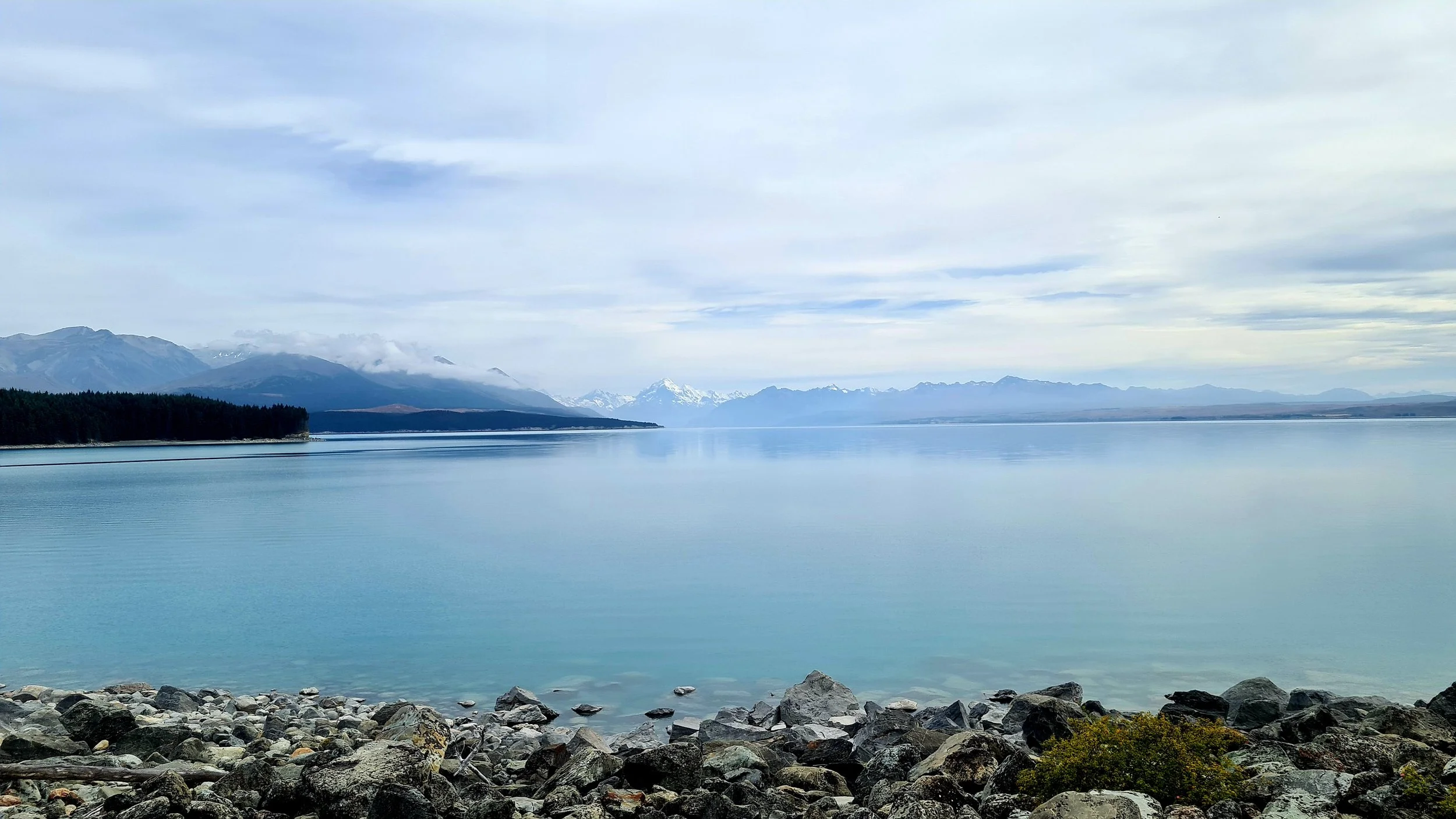
Lake Pūkaki is turquoise because it contains glacial sediment known as rock flour. Image: LEARNZ.