How scientists study glaciers
Scientists who study glaciers are called glaciologists. Climate scientists also study them to assess how temperature changes affect the environment. These glacier detectives search for clues in the ice they find high up in the freezing mountains.
Why study glaciers?
Glaciers aren't just giant chunks of ice; they matter to our planet. Scientists study them for three main reasons:
They are nature’s thermometers: Glaciers are incredibly sensitive to changes in temperature and precipitation (rain and snow). They can tell us a lot about how the environment is changing.
They are frozen time machines: Deep inside the oldest layers of ice, bubbles of air are trapped from hundreds or even thousands of years ago. By looking at this old ice, scientists can see what the weather was like long before humans were even here.
They are giant water stores: Glaciers store massive amounts of fresh water. When they melt a little bit in the summer, they fill up rivers that people use for drinking water, farming, and generating electricity.
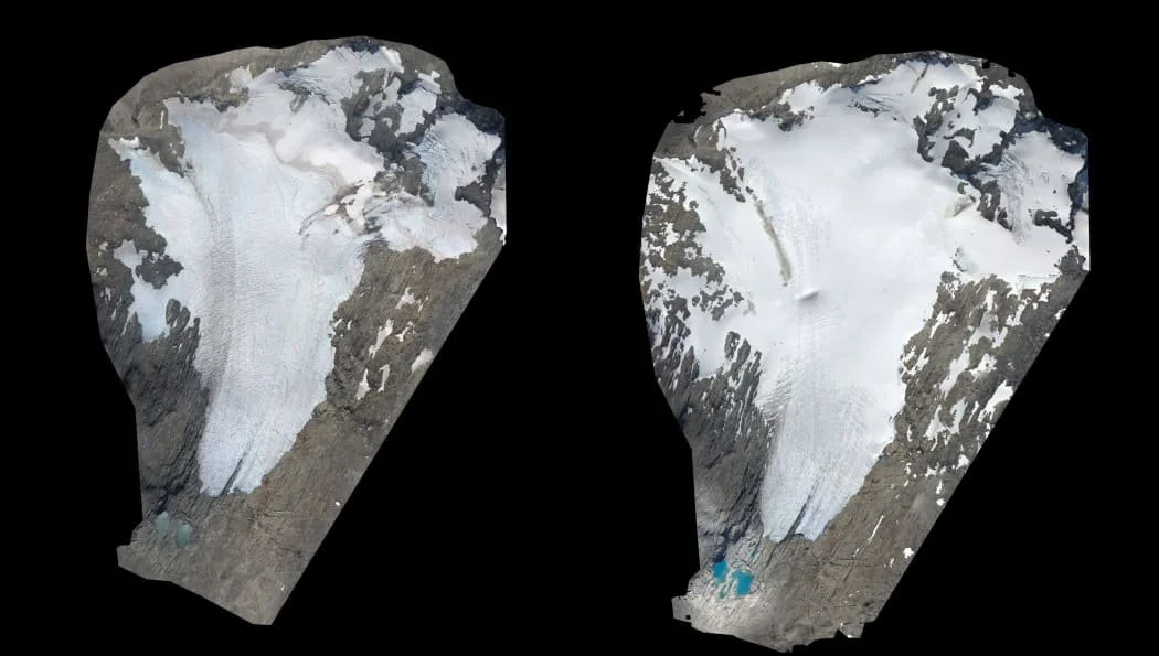
Images from the Snowline Survey showing recession on Brewster Glacier.
The ultimate glacier-spying toolkit
To see how glaciers are changing, scientists compare what the ice looks like today with how it looked in the past. They use some cool gadgets to do this:
Snow Markers: Scientists hike onto the ice and plant giant stakes into the glacier at the end of summer. Later, they come back to check the stakes to see exactly how much new snow fell or how much ice melted.
Maps: By comparing old paper maps with modern digital maps, scientists can count the glaciers. In 1978, the first New Zealand glacier count found 3,144 individual glaciers.
LiDAR Light Detection and Ranging: Scientists bounce safe laser beams off the ice from aeroplanes to measure exactly how thick the glaciers are and how fast they are sliding down the mountain.
Thermal Cameras: These are special heat-vision cameras which show different temperatures on and around a glacier. They show scientists how hot the rocks next to the glacier are getting, which helps them understand why some glaciers melt faster than others.
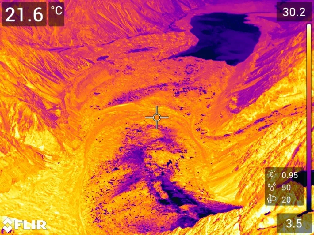
A thermal image of Haupapa | Tasman Glacier showing different surface temperatures. Image: Andrew Lorrey NIWA.
The great annual snowline and glacier survey
Every year since 1977, scientists have hopped into a small aeroplane at the end of summer to fly over more than 50 glaciers in the South Island. Earth Sciences New Zealand has carried on this tradition, and it is now one of the longest-running glacier observations in the world.
During the flight, scientists take thousands of photos to check the snowline—the line that shows where the white winter snow ends, and the bare blue glacier ice begins.
Think of the snowline like a health checkup for the glacier:
High Snowline = Bad News: If the line is higher up the mountain, more winter snow melted away, and the glacier is losing mass and shrinking.
Low Snowline = Good News: If the line is low, more winter snow remains to feed the glacier, so it gains mass and advances.

The end-of-summer snowline survey is completed each year by Earth Sciences NZ. Image: Earth Sciences NZ.
On the Snowline Secrets field trip, you get to virtually climb into the plane with the Earth Sciences NZ team. You will fly high above Kā Tiritiri o te Moana | the Southern Alps to help them complete their 2026 summer ice survey.