Date:
Monday, May 11, 2015


You can contact LEARNZ, part of CORE Education, at:
Postal Address:
PO Box 13 678,
Christchurch 8141,
New Zealand

Kia ora koutou,
The first day of the High Country hi-tech field trip has finally arrived but to truly begin the field trip we had to hit the road and drive from Dunedin to Twizel.
Marvels of mother nature at Moeraki
You travelled north along State Highway 1. There wasn’t much in the way of traffic so it was easy to enjoy the scenery and stop whenever anything interesting came into view. The first place the ambassadors wanted to stop was the famous Moeraki Boulders. The Moeraki Boulders are unusually large and almost perfectly round boulders lying along a stretch of Koekohe Beach near Hampden. These boulders are actually concretions that have been exposed through shoreline erosion from the coastal cliffs above the beach. A concretion is a hard solid mass formed as material gathers in one place over time. They originally formed in ancient sea floor sediments around 60 million years ago. The Moeraki Boulders are protected and attract thousands of tourists each year who come to photograph the weird and rather special rocks.
Local Māori legends explained the boulders as the remains of eel baskets, calabashes, and kumara washed ashore from the wreck of Arai-te-uru, a large sailing canoe.
Following the GPS on your phone it wasn’t long before you were told to turn inland at Weston. The road took you up into limestone country. Here you discovered the Vanished World of Duntroon. Volunteers run a visitor centre displaying ancient fossils and bones found in the local limestone outcrops and there are over 20 different sites to visit in and around the Waitaki Valley and North Otago coast.
Vanished World
You stopped off at one site known as Takiroa; an important landmark for Ngāi Tahu Whānui. This limestone rock shelter lies on an ancient ara or pathway following the Waitaki River from the mountains to the sea. The headwaters of the Waitaki River are fed from Ka roimata o Aoraki – the tears of Aoraki, the ancestral mountain of Ngāi Tahu Whānui and it is these waters that also feed the Mackenzie Country where you will be based for the next few days. Visiting Takiroa was a good way to be reminded of the people who passed through this land hundreds of years ago and to see the rock art they left behind.
Up the Waitaki Valley
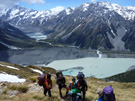
The road followed the Waitaki River up into the highcountry and tiny patches of snow could be seen on the mountains surrounding the valley. In another month these mountains will be cloaked in snow but for the moment you could enjoy the bright orange colours of autumn. This area has been changed dramatically by hydro-electric power generation. The sloping country side and large rivers make it perfect for generating lots of electricity. You may want to find out more about the dams and hydro lakes which have been created here.
On to Omarama
The clouds grew darker in colour as you headed west and despite the sunshine it was obvious that rain was on its way. By the time you reached Omarama thunder rolled around the hills and heavy rain set in. Omarama means place of light in Māori in reference to the amazing clear skies of the area. In fact nearby Aoraki Mt Cook National Park and the villages of Lake Tekapo, Twizel and Mt Cook are all part of a dark sky reserve. This reserve recognises the clear skies of the area which are almost free of any light pollution. This is the perfect place to come for star gazing – when it isn’t raining of course!
Omarama is also famous for its gliding and the World Gliding Championships were held here in 1995. Air that descends down the mountains warms and rises making it ideal for gliding, not to mention spectacular. Sadly all the gliders were grounded in the stormy weather so you headed on towards Twizel.
In to the heart of the Mackenzie Country
Twizel will be your home for the next four days. Twizel is the largest town in the Mackenzie District, and is surrounded by mountains and glacier-fed lakes. The town has not been here for that long, it was built in 1968 to house construction workers on the Upper Waitaki Hydroelectric Scheme. Twizel now has a population of around 1,200 people.
You will meet some of the locals during this field trip and also people from Land Information New Zealand as you investigate some of the incredible technology used to manage this unique environment.
See you tomorrow,
Shelley the LEARNZ field trip teacher.

The Moeraki Boulders are marvels of mother nature found on the east coast of Otago. Image: LEARNZ.

The Moeraki Boulders originally formed in sea floor sediments 60 million years ago. What is the name of this type of boulder? Image: LEARNZ.

Shelley checks out a Māori rock art site near Duntroon on the Vanished World trail. Image: LEARNZ.

This Māori rock art at Takiroa is hundreds of years old and shows where Māori sheltered as they travelled through the Waitaki Valley. Image: LEARNZ.

Autumn colours brightened the Waitaki Valley despite the dark clouds that threatened rain. Image: LEARNZ.

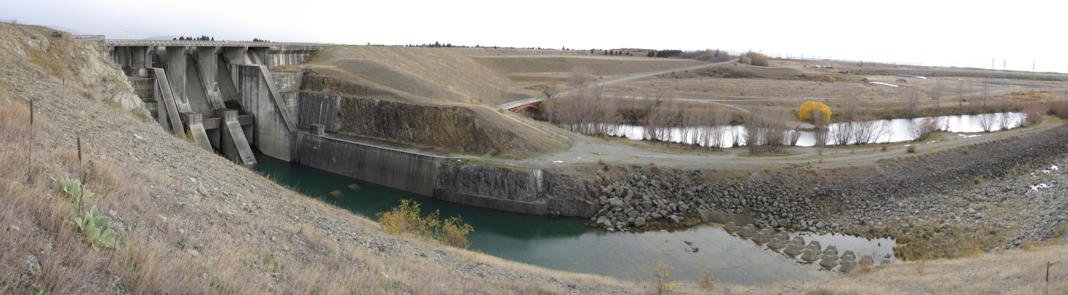
The curved Waitaki dam is the first in a series of hydro electric dams in the upper Waitaki and Mackenzie Country. Why do you think this area is good for generating hydro-electricity? Image: LEARNZ.

Aviemore is another dam further up the Waitaki Valley. Image: LEARNZ.

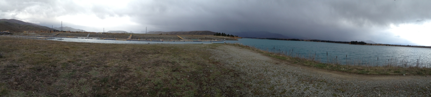
A successful salmon farm can be seen on Lake Ruataniwha. Image: LEARNZ.

Shelley and the ambassadors make it to Twizel in the heart of the Mackenzie Country. Image: LEARNZ.