Date:
Tuesday, May 12, 2015


You can contact LEARNZ, part of CORE Education, at:
Postal Address:
PO Box 13 678,
Christchurch 8141,
New Zealand


Kia ora koutou,
We woke to the sound of heavy rain on the roof and once the cloud cleared you could see fresh snow on the hills. Luckily by the time we had driven out to the shores of Lake Pukaki the rain had stopped. Here you met Marcus Girvan who was eager to demonstrate how he uses drones to monitor wilding trees.
Flight of the drone
Drones have changed a lot since they were first used by the military and now are mostly remotely controlled smaller aircraft that can be used for everything from weed management to police surveillance. It didn’t take Marcus long to set up his drone. Once the battery was connected and the rotors attached all it had to do was power up and connect with GPS satellites and the control unit. Before you knew it the drone was whizzing out over the high country recording everything below it on a camera. You could see exactly what the drone could see through the hand held display which picked up a signal from the drone. It made me want to buy a drone to take on LEARNZ field trips for filming but new rules mean that you can’t be within 4km of an aerodrome or fly the drone further than you can see. You can check out the other rules for using drones on the background pages.
The fight against wilding pines
Drones have made the biosecurity work that Marcus does much easier and more efficient. The drone can be used instead of a helicopter at a fraction of the price and fly closer to the ground to monitor the spread of weeds such as pine trees. The radiata pine is a common forestry tree but because conditions in New Zealand are so favourable to its growth it has often spread into other areas. These uninvited trees are known as wilding pines and can take over farm land, reduce soil moisture and out compete native species. These trees provide none of the advantages offered by native species, such as berries and nectar, which encourage bird life and insects. Pine needles form a carpet which discourages regeneration of native forest floor species. In the Mackenzie Country wilding pines are a threat to the unique ecosystem so it’s great to see drones being used to help control them.
However, the high country isn’t the easiest place to use drones. Most drones are not waterproof so can’t operate in the rain. Luckily Marcus had managed to find a gap in the weather allowing the flight to go ahead. Extreme temperatures and high winds are also hard on drones and most drone crashes occur when it's really windy. You can find out more about drones by watching the videos.
Drones of the future
You headed back to the car to escape the cold weather and talk to Rosebank School and Waterloo School during the field trip audioconferences. Students had interesting questions about drones and how they are used. Marcus believes that in the future drones will not just be useful in monitoring the spread of wilding trees but also in killing these weeds. Drones of the future could carry weed spray and run image recognition software that identifies weeds and then sprays them. Imagine how much easier this would make weed control! You can listen to the recorded audioconferences to find out more.
Knowing where you are with GPS
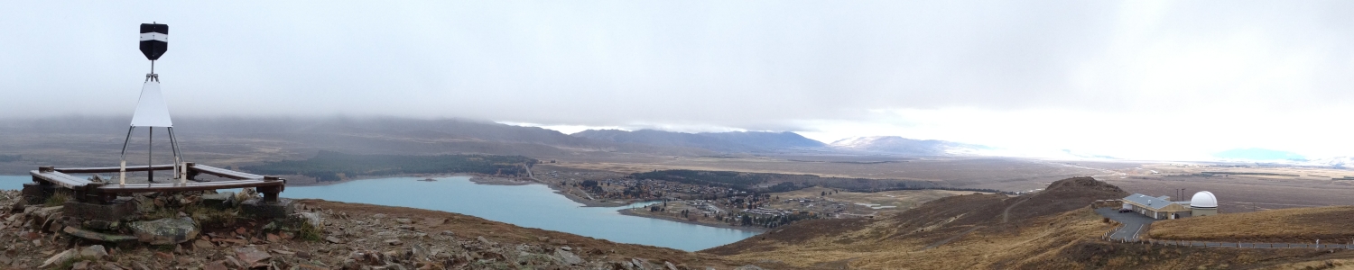
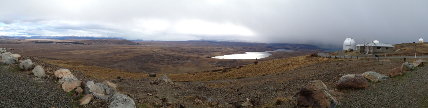
After lunch you headed up to Mount John Observatory near Tekapo to find out more about GPS. Paula Gentle for LINZ (Land Information New Zealand) met you at the lookout but unfortunately the weather was rather bleak and the view less spectacular than usual. You braved the bitterly cold winds and rain to check out the Continuous GPS station that is located here. This station is one of about thirty in New Zealand that LINZ maintains as part of our national positioning system known as the Geodetic Network. Unlike handheld GPS or the GPS on your smart phone these stations give very accurate positions which then allow really accurate measures of things like sea level rise, plate movements and even changes in ice sheets and glaciers. This information helps to identify areas at risk of flooding, earthquakes and drought. Even getting accurate measures of landmarks can be done much more quickly and easily using GPS rather than the old methods of surveying based on distances from known stars. Now a global network of satellites are used to give the co-ordinates of any location. Provided a GPS receiver can pick up at least four satellites an accurate location can be found. You can find out more in the videos.
Paula also talked about how surveyors from the University of Otago were able to find a more accurate height of our sacred Aoraki/Mount Cook. This work would have taken weeks in the past but GPS technology allowed the team to record an accurate height after reaching the summit. You can find out more by visiting the Otago University School of Surveying website.
The art of geocaching
Sleet forced you back to the warmth of the car and you headed back to Twizel to meet some local school students. These students have been discovering more about the global phenomenon known as geocaching. Geocaching involves finding stashes that have been hidden all over the world. A website and app give clues and GPS co-ordinates of local geocaches that people can then try and find, swap or move. Visit the Geocache website to register. Jake, Amy, Kaia, Mac and Holly took you on a geocache hunt in Twizel. You can watch the video to see what they found. This is a great way to get to know your local area and you can even place your own geocache items with instructions so that they can then travel the world!
After such a busy day exploring the high country I’m sure you are looking forward to a relaxing evening.
See you in the morning,
Shelley the LEARNZ field trip teacher.

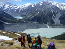
Looking across Lake Pukaki there was no sign of Aoraki Mount Cook which was buried in cloud. Image: LEARNZ.

Marcus Girvan prepares his drone to fly over the shores of Lake Pukaki. What does a drone need to fly? Image: LEARNZ.

The drone is launched and begins its flight. Image: LEARNZ.

Marcus controls the drone with a remote control unit. How is this drone used in the high country? Image: LEARNZ.

A hand held display shows what the drone is recording on its flight. Image: LEARNZ.

The ambassadors discover a wilding pine tree. Why are these trees such a problem? Image: LEARNZ.

Marcus talks to Shelley about how drones are used to monitor wilding pines in the high country. How is this monitoring work done? Image: LEARNZ.

Shelley and Paula Gentle from LINZ brave the cold weather to investigate a continuous GPS station on Mount John. What are these stations used for? Image: LEARNZ.

Students from Twizel Area School take you geocaching. Image: LEARNZ.

Amy, Mac, Jake and Kaia hunt down a geocache in Twizel by using GPS and deciphering clues. Image: LEARNZ.