fbpx Adding More Information to Maps With GIS | LEARNZ

Adding More Information to Maps With GIS

«Previous
GPS Global Positioning Systems
Next»
Topographic Maps
Listen: 

GIS stands for Geographic Information System. GIS uses software to add different sets of information as layers on a map.

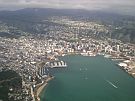
Maps have come a long way since people first began drawings to show where they were.

Modern maps are made using special software that combines lots of different sorts of information. This system of modern mapping is called GIS – Geographic Information Systems. GIS is used by groups such as Kiwi Rail and City Councils. GIS gives access to data and shows different sets of data together.

GIS gives people a picture of data that allows them to:

  • problem solve
  • write reports
  • track changes
  • make decisions
  • plan for the future e.g. which areas could be used to build houses.

GIS needs four things: 

  1. People: people who are trained in GIS.
  2. Data: geospatial information (where things are located) is entered into the GIS software.
  3. Software: GIS software analyses data and presents it in different ways for the user.
  4. Hardware: includes hand held devices for collecting data and computers with GIS software.

Data in a GIS system is stored in sets called ‘data sets’ in a database. Data sets can be turned on and off so they are shown all together or separately as layers on a map:

GIS Layers

Audio Māori keywords: 


If you were planning a school camp what information would you want to see on a GIS map of possible camping locations and where might you find this information?

Within two hours of the February 22 2011 earthquake in Christchurch, Eagle Technology Ltd had a Christchurch Earthquake Incident Viewer up and running on the internet. This showed the public important information overlaid on to a map. Image: Eagle Technology Ltd.

This GIS shows building footprints in Wellington City. Image: Koordinates.

«Previous
GPS Global Positioning Systems
Next»
Topographic Maps

Comments

I wonder if a school should "GIS" itself

Comment: 
I wonder if a school should "GIS" itself. It could be good to geotag everything in a school so you could show and hide layers of things like sports equipment, teaching resources, data projectors, and computers. One day if things all has GPS embedded you could find them even when someone moved them.

gis

Comment: 
it would be good for Kaniere's school sport shed.