Te tapa whenua: Naming the land
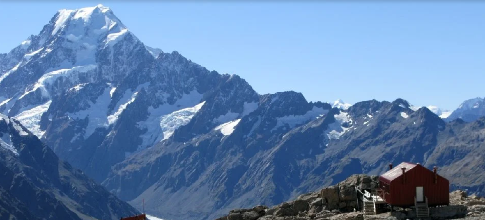
Aoraki Mount Cook National Park bears names of great significance to Ngāi Tahu.
About this field trip
Place names tell us where we are and where we might want to go. On maps they help us find our way around. But place names are also important landmarks of the history, culture and identity of our nation and the communities within it. Before Māori language was written down, tapa whenua helped to record history and define relationships between people and the land. These place names tell stories of creation, ancestors, explorers, and notable events, as well as describe landscape features and identify resources.
Travel online with LEARNZ to:
discover the stories and reasons behind Ngāi Tahu place naming throughout this area
explore the connection of people to special places and environments
inquire into how place names represent the story of settlement by a range of people in Aotearoa New Zealand
consider the importance of place names and their stories being handed down, retained and restored
inquire into the significance and stories behind place names in your own rohe.
Educator guide
New Zealand Curriculum (NZC)
This field trip supports a cross-curricular approach to teaching and learning. It is guided by the 2007 New Zealand Curriculum and Te Mātaiaho –The Refreshed New Zealand Curriculum (2022). It aligns best with, but is not limited to, the learning areas, year groups and progressions presented below.
Select one or more learning areas, concepts and progress outcomes to suit your students’ interests and learning needs.
Use this learning experience as a springboard for multiple areas of inquiry. Look for ways to make connections to learning that matters to students, as well as nationally and locally.
Learning areas and achievement objectives
-
Understand
Māori history is the foundational and continuous history of Aotearoa New Zealand.
Know
Tūrangawaewae me te kaitiakitanga | Place and environment:
Tangata whenua are deeply connected to the local area. Naming places was key to establishing and maintaining mana and tūrangawaewae.
Many of the name of geographical features; towns, buildings, streets, and places tell stories. Sometimes there is more than one story.
Do
In my learning in Aotearoa New Zealand’s histories, I can:
retell a story from the past and talk about how other people might tell it differently.
use historical sources, giving deliberate attention to mātauranga Māori sources, to help answer my questions about the past.
Inquiry practice that brings rigour to learning:
Key questions:
What are the names of the features of the landscape in our area? Do some features have more than one name? If so, why, and where do the names come from?
How did Māori name marae, hapū, iwi, and features of the landscape? How and why have some place names in Aotearoa New Zealand changed?
Learning experiences – Explore examples of:
tangata whenua connections to the local area – names of marae, hapū, iwi, and geological features and how they relate to experiences and whakapapa
names of geographical features, towns, places, streets, and buildings, and the stories people tell about those names.
Progress outcome by the end of year 8:
Understand
Relationships and connections between people, across boundaries, and with the environment shape societies.
Know
Tūrangawaewae me te kaitiakitanga | Place and environment
Māori cared for and transformed te taiao and expressed their connection to the place by naming the land and its features.
Do
Identifying and exploring historical relationships
I can construct a narrative of cause and effect that shows relationships between events. By comparing examples over time, I can identify continuity or changes in the relationships. I can recognise that others might interpret these relationships differently.
Identifying sources and perspectives
I can use historical sources with differing perspectives on the past, giving deliberate attention to mātauranga Māori sources. I can recognise that the sources may not fully answer my questions and that my answers are themselves interpretations.
Inquiry practice that brings rigour to learning:
Key question:
What practices of Māori transformed the natural environment? How did Māori express their kinship with and custodianship of the environment? How did naming features of the land express their connection with it?
Learning experiences – Explore examples of:
how iwi gave expression to their world-view of a deep kinship and holistic relationship between themselves and the natural world.
naming as an expression of connection to places, features of the natural environment, flora, and fauna.
-
Listening, reading and viewing
Ideas: Show a developing understanding of ideas within, across, and beyond texts.
E.g. Indicators at level 3:
uses their personal experience and world and literacy knowledge confidently to make meaning from texts
makes meaning of increasingly complex texts by identifying main and subsidiary ideas in them
starts to make connections by thinking about underlying ideas in and between texts
recognises that there may be more than one reading available within a text
makes and supports inferences from texts with increasing independence.
Discover more
Background reading, images, narrations, and keywords.
Early exploration and place naming
When the Polynesian tūpuna | ancestors of Māori arrived in Aotearoa New Zealand, they named many places.
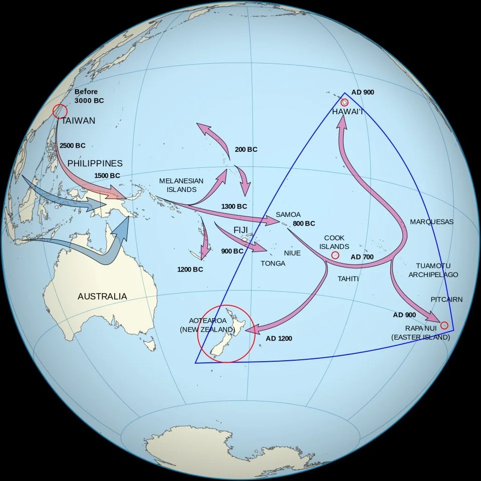
Place names from Polynesia
The ancestors of Māori often gave names from Polynesion mythology to the New Zealand landscape. People brought their traditions from island to island over centuries of migration.
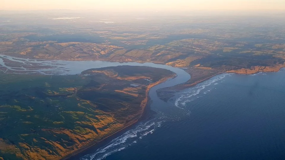
Events, songs, and chants
The ancestors of Māori often gave names from Polynesion mythology to the New Zealand landscape. People brought their traditions from island to island over centuries of migration.
Early European place naming
European explorers and map makers who arrived by ship gave Aotearoa New Zealand the first European names. These early names usually first appeared on maps and follow the coast or places sighted from it such as mountains.
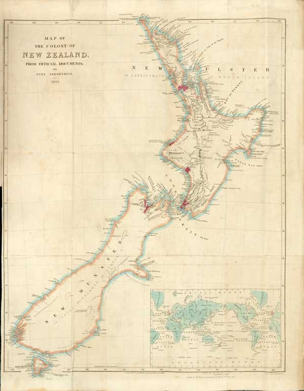
How did New Zealand Europeans name places?
New Zealand’s non-Māori place names tell the story of the country’s European habitation. As Europeans surveyed, acquired, and changed New Zealand’s landscape they replaced older Māori names.
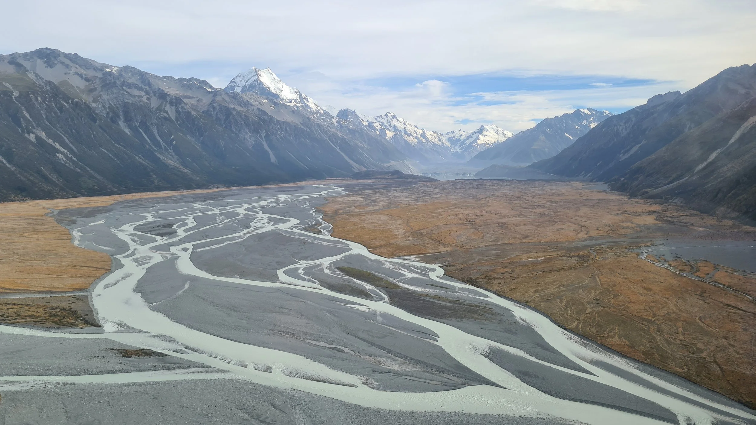
Restoring Māori place names
European names replaced Māori names on maps, but many Māori names survived. Some Māori names were replaced but then returned. Over time, other original Māori names have been restored.
Connect with field trip experts
Insights into people and their careers.
Meet David - he knows the stories behind the place names of Te Wai Pounamu, Aotearoa.
Field trip videos
Videos and more showcasing places, people, ideas and initiatives on this field trip
The significance of Māori place names
Tā Tipene O'Regan, among many other titles and roles, is a person dedicated to researching and preserving the history and knowledge base of Ngāi Tahu iwi. In this video, Tā Tipene introduces himself and talks about the significance of place names as a way to record and remember tribal history and other valuable information.
The Aoraki creation story
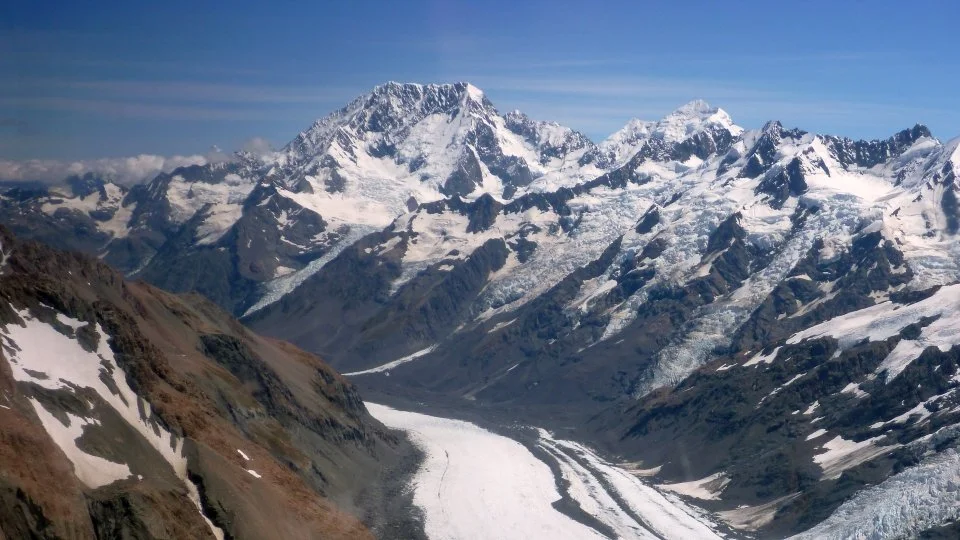
Tā Tipene O'Regan retells the Aoraki creation story. In this account, Aoraki and his brothers travelled in their waka down from the heavens to visit Papatūānuku. On their attempt to return the waka fell back into the water, forming "Te Waka-o-Aoraki", an early name for the South Island. The brothers all turned to stone, becoming some of the dominant mountains of Kā Tiritiri-o-te-moana (the Southern Alps), Aoraki being the highest.
Punatahu
Punatahu is located in an area known as Te Manahuna (the Mackenzie Basin). For centuries, Te Manahuna was a key part of the Ngāi Tahu mahinga kai network. It is also the name given to the visitor centre located on the shores of Pūkaki.
Rākaihautū and the creation of Lake Pūkaki
Rākaihautu was the captain of the waka Uruao, which brought the iwi Waitaha to Aotearoa. He and his crew named many of the places in this area.
Kā Roimata o Aoraki - the tears of Aoraki
Kā Roimata o Aoraki, the tears of Aoraki. Sitting beside this special awa, overlooked by the mauka (maunga) Kirikirikatata, the pōua (grandfather) of Aoraki, David Higgins shares his knowledge about how these waters are a vital link in the whakapapa of this rohe.
Ārai-te-uru tradition of Aoraki
After capsizing on the Otago coastline, many of the passengers on board the Ārai-te-uru waka went ashore to explore the land. This included Kirikirikatata who carried his grandson, Aoraki, on his shoulders.
Kā Huru Manu
David Higgins about Kā Huru Manu, The Ngāi Tahu Cultural Mapping Project. This project is dedicated to mapping the traditional Māori place names and associated stories within the Ngāi Tahu rohe.
Web conference
Play the recording of the web conference, a conversation between David, Upoko - Te Rūnanga o Moeraki - Ngāi Tahu, and Duvauchelle School (on Banks Peninsula, east of Christchurch).
The following questions are answered in the podcast above:
What does the place called Pohatu (related to penguins) mean?
Are there any other names for Akaroa?
How did Robinsons bay get its name?
Why are there so many pukekos in Robinsons Bay?
Why is Takamatua called Takamatua?
How did Barry's Bay get its name?
Why was Duvauchelle called Kaitouna?
Are there any other Māori names for Duvauchelle?
Please tell us more about Bossu, which is a big lump in the hill.
How did Wainui get its Maori name?
Why is Wakaroa the Maori name for Pigeon Bay?
Does Pigeon Bay have any more Māori names besides Whakaroa?
Learning activities
Project-based learning approach
Project-based learning (PBL) is a suggested teaching and learning approach to support student-led inquiry into an area of interest. PBL provides opportunities for students to build key competencies and skills such as:
critical thinking
problem solving
collaboration
self-management.
Use the Te tapa whenua online field trip to ignite student curiosity and questions, and the following framework to support student-led learning through PBL.
-
Individually or in a group, students can explore resources in this field trip to:
Discover more: Interesting background information, images and page narrations about the field trip topic.
Connect with experts: Insights into field trip people, their interests and careers.
Explore field trip videos: Field trip videos and information–Use the questions on this page to help students consider key concepts.
Te tapa whenua on Google Earth: A virtual experience using interactive maps, 3D images, video images and information.
-
Project-based learning requires a meaningful and authentic problem to solve or question to answer. Support students to identify an area of interest, including a problem to solve or question to answer, For example:
Problem: Our town/mountain/river etc are known mostly by their Pākehā names, but there are Māori names for these features too.
Question: So... what do locals think about changing the names of existing places/landscape features? Why do they hold these views?
Students can identify their own problem and question to answer as they engage with this field trip, supported by the following questions:
What do you SEE?
What do you THINK?
What did you WONDER about?
What QUESTIONS do you have?
What do you want to FIND OUT MORE about?
-
Help students to establish goals, plan, connect and create content and/or a solution. For example:
Plan and approach: Students could ask their family/whānau and survey local members of their community about their opinions on changing these names.
Solution: Students could be supported to recognise different perspectives or world views that shape broad categories of responses.
-
Share
Students analyse who they want to know about their project and why. Essentially who cares?
Who in the school and community would benefit from their ideas and information?
What careers connect with their ideas and information?
What organisations can use student ideas and information?
Is there need for a wider audience? National? Global?
Students identify how they will share their content for effective impact. Some examples include, but are not limited to:
School assembly and communications with whānau.
Showcase in a local library, community centre, cafe and/or to a local business.
A community event
Digital platform: in a movie, website, Google Earth for Web, on a school social media platform.
Local media outlets.
Share your students' work with LEARNZ!
Send us a small file (less than 10Mb). You can do this as an attachment to share@learnz.org.nz.
If it's a large file, send a link to a public file/resource to share@learnz.org.nz.
For example, entries can be uploaded onto a YouTube account with the privacy option on ‘Public'. Or send a link to a file in your school Google drive, set it to ‘Anyone with a link’, as ‘Viewer’. Please do not send in large source files. Make sure you provide us with your students' first names, year group/s and the name of your school in your email. Add a brief description if you think it's needed. Before your students share any learning, please ensure you review it first; Any other media content, such as images and sound, need to adhere to appropriate Creative Commons licensing. Make sure any people who are in images and video have given their permission to feature.
-
Your students can complete the online student pre-assessment and post-assessment forms for this field trip. Once completed you can email help@learnz.org.nz to have your class submissions extracted and emailed to you. It's OK if just some of your students have filled them in or if they have submitted either self assessment rather than both.
-
Video question sheet - Word (31k) | PDF (217k) | Google doc to use for each video (based on SOLO Taxonomy).
Web conference activity: Students can work on this activity while they listen to live or recorded web conferences - PDF (118k) | Google Doc. Notes from these pages could be shared to help put together the class web conference summary.
Webconference summary sheet: A class summary of an web conference is a great way of reviewing the information your students heard. It's easy to do, purely as some text, or as main facts on a picture background. - PDF (78k) | Google doc.
The LEARNZ team would love to see how students and teachers are participating in this trip! We will use your mahi to improve this and other online field trips, as well as share and credit any teacher and student contributions in our online spaces! Send to: share@learnz.org.nz

This trip reflects the United Nations Sustainable Development Goals (SDGs), especially Goal 16: Peace, justice and strong institutions: Promote peaceful and inclusive societies for sustainable development, provide access to justice for all and build effective, accountable and inclusive institutions at all levels.
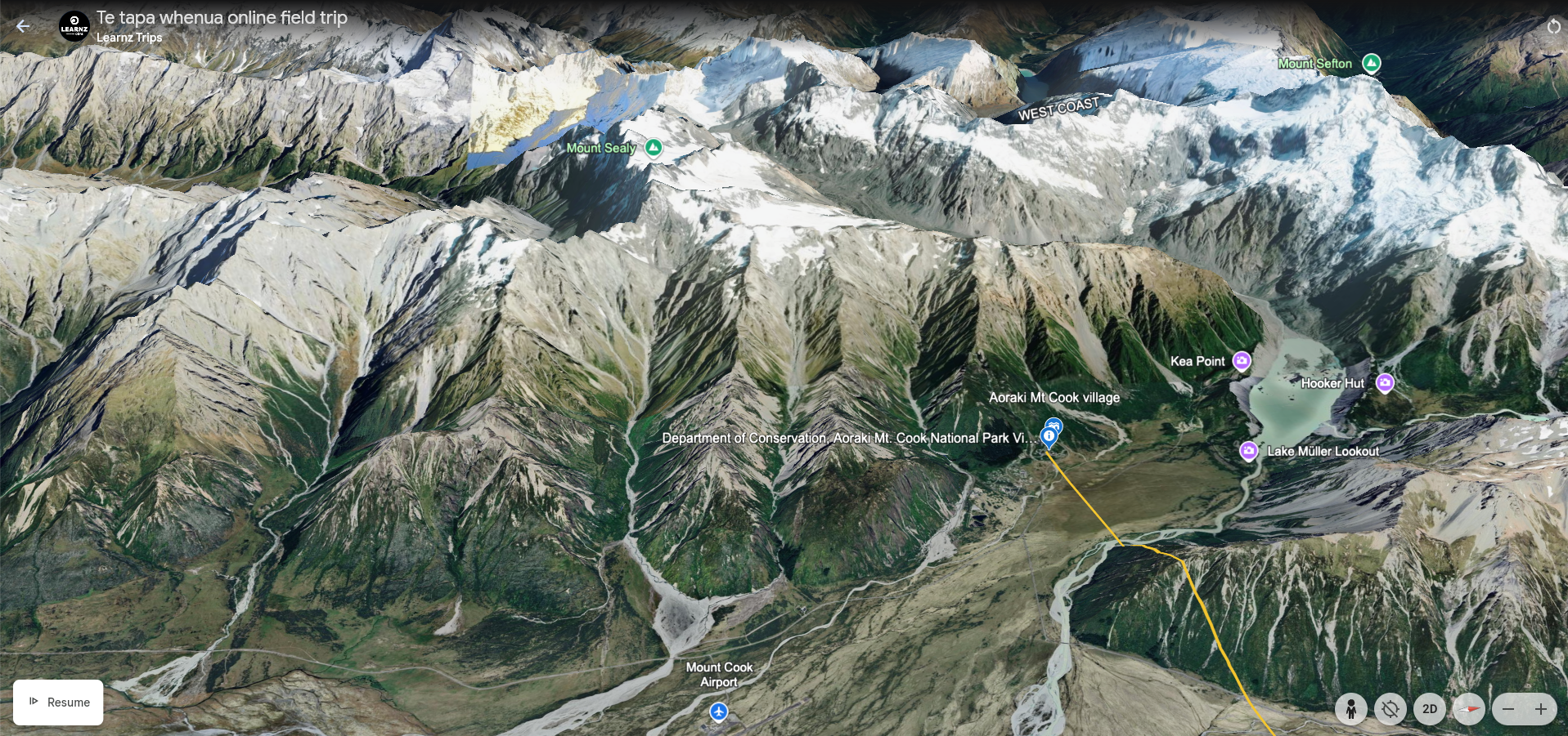
Take the Google Earth tour
Take the Google Earth for Web tour to Aoraki
A virtual tour of the field trip with GIS mapping, 3D locations, images, daily diaries and video.
Resources and links
Kā Huru Manu - project dedicated to creating a Ngāi Tahu atlas of place names and histories.
Kā Huru Manu education framework - A framework for using the Ngāi Tahu Cultural Atlas to teach social studies in Years 7-10.
Kareao: Ngāi Tahu Archive - comprises the collections of the Ngaitahu Maori Trust Board, the records of Te Rūnanga o Ngāi Tahu, and the personal papers of selected individuals.
Aoraki Creation Story - Narrated by Tā Tipene O'Regan, this visually stunning short film tells the Ngāi Tahu creation story of Te Waka-o-Aoraki and more widely Te Waipounamu.
Aoraki Creation Story in te reo - this contemporary animation uses whakapapa recorded by Ngāi Tahu rangatira Matiaha Tiramōrehu, and the motif of kōwhaiwhai to present a version of one of the Ngāi Tahu creation stories.
Stories of our Māori place names - teaching unit from Waitangi Treaty Grounds.
Find Māori place names - Toitū te whenua/Land Information New Zealand has a guide on how to find Māori place names.
Map of Aotearoa New Zealand featuring names relating to the legend of Māui.
Aotearoa map of place names - downloadable map of some of Aotearoa New Zealand's main place names.
Place names from Cook's voyages - Read more about the place names given during Lieutenant James Cook’s first encounters around our shores in this Google Earth tour. Included are original Māori place names.
Glossary
Colonise, colonisation
Colonisation is the act of one country settling another place, to become the new rulers of the new country, and to live in the new country.
Commemorate
Mark an event or person by doing or producing something. Recall and show respect for something or someone.
Creation myth
A symbolic story of how the world began and how people first came to inhabit it.
Cultural icon
A cultural icon can be a symbol, logo, picture, name, face, person, building or other image. It is easily recognized and generally represents an object or idea with great cultural significance to a wide cultural group. It has a special status as representing, or important to, or loved by, a particular group of people, a place, or a period in history.
Double (dual) naming
The adoption of an official place name that combines two earlier names. For some of these in Aotearoa New Zealand, either name (usually Māori or English) can be used.
European
In Aotearoa New Zealand, Europeans are New Zealanders of European descent.
Founding ancestor
The first people to arrive in Aotearoa New Zealand were the ancestors of Māori. These first settlers arrived from Polynesia approximately between 1200 and 1300 AD. They discovered these lands as they explored the Pacific, navigating by the ocean currents, winds, and stars. Often celebrated, the founding ancestors were the first people to name places, in many cases after themselves.
Geographical feature
Often a landform such as hills, cliffs, mountains, valleys, rivers, lakes, harbours etc.
Legend
An old story about famous people and events in the past.
Lineage
The ancestors from whom a person comes from.
Immigrant
People who move to a new country to live there.
Māori
Māori are tangata whenua, the indigenous (original inhabitants) people, of Aotearoa New Zealand.
Metaphorical
Something is metaphorical when you use it to stand for another thing.
Pākehā
New Zealander of European descent.
Polynesian
Polynesia is a subregion of Oceania, made up of more than 1,000 islands scattered over the central and southern Pacific Ocean. The indigenous people who inhabit the islands of Polynesia are called Polynesians.
Restore, restoring
Bring back, re-establish, repair.
Migration
A journey, often seasonal, from one region to another.
Oral map
Place naming for Māori was a way of mapping an area. Place names often had stories, waiata, or chants behind them, serving as triggers for memory of such things as the value, use, ownership, past events, people etc of that place.
Oral tradition
Like a spoken story that works to store and communicate knowledge, culture, and ideas.
Settlement
A place, usually one which has been uninhabited, where people set up a community. Official agreement that resolves a conflict.
Settler
A person who moves with a group of others to live in a new country ore area.
Surveyor
A person whose job is to measure and describe the details of an area of land.
Tradition
Traditions can be stories, beliefs, and customs that are maintained and passed on from one generation to another.
Whakapapa
Genealogy. But it literally means to create a base or foundation. Whakapapa is the recitation of genealogies or stories which create a base or foundation of meaning for people. As whakapapa can include genealogies or stories about the entire world, whakapapa are ways by which people come into relationship with the world, with people, and with life.