Date:
Wednesday, August 1, 2018


You can contact LEARNZ, part of CORE Education, at:
Postal Address:
PO Box 13 678,
Christchurch 8141,
New Zealand
Kia ora tātaou
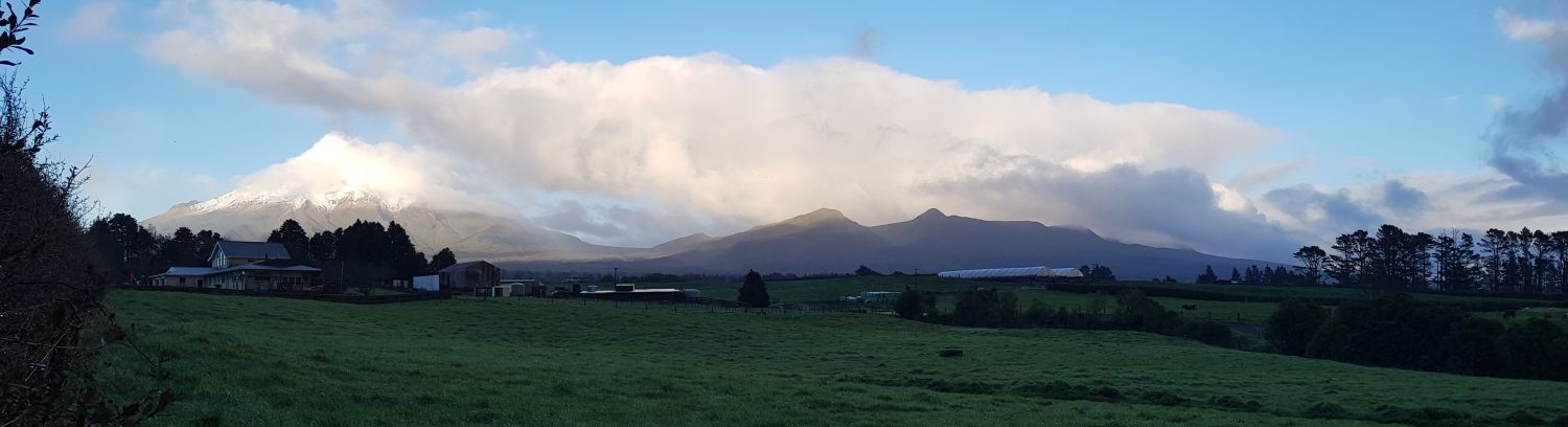
There were some magnificent views of Taranaki Maunga on the way to Egmont Camphouse this morning. It sure is a good-looking mountain. I can see why there are people here determined to make it even better.
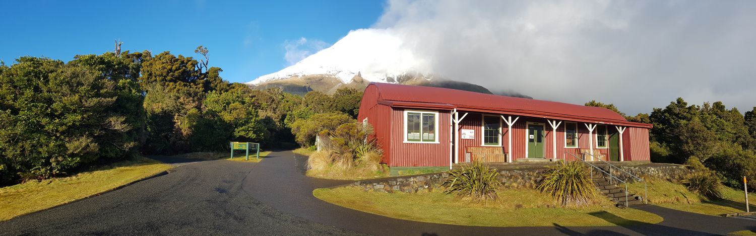
Web conference at Egmont Camphouse
This morning’s web conference was in an old building called Egmont Camphouse. In fact it is New Zealand’s oldest building within a national park. It is an old military barrack that was moved here in 1892. You can get an idea of what it looks like in its surroundings with this Google street view image that Duane Wilkins took this morning.
Our main experts for the web conference were Joe Carson and Emily King. Our speaking school was Turitea School in Palmerston North. We once again had some excellent questions. I sure am learning a lot this week because of these questions and answers, so thank you!
Citizen science with iNaturalist
After a bit of morning tea, Emily talked with us about bird identification. A big part of the Mounga Project is reintroducing bird species that have disappeared from the mountain over the years. We talked with Emily about how we can all play a part in helping scientists to build a picture of where certain birds are in New Zealand and how their populations are doing. Contributing data in this way is called citizen science. One tool that enables you to do this is iNaturalist (https://www.inaturalist.org/).
Emily showed us how to record an observation using the iNaturalist app on her phone. This is certainly handy when you’re out and about and want to make an observation. Later that day, Duane Wilkins talked through how to access i-Naturalist on a larger device such as a laptop. He used the ‘explore’ function to see observations of whio that have been made. It was cool to see on the map where, when, and how many whio people have seen. Have a look at both videos and see how you could use iNaturalist for your own inquiries.
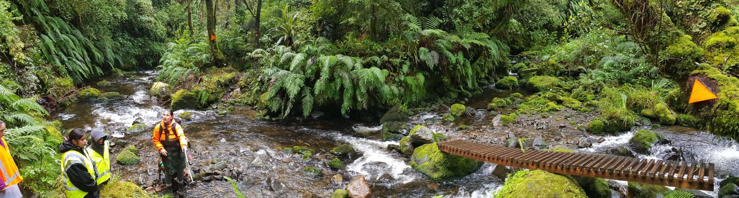
Monitoring whio with Joe and Tai the dog
We made our way along the Ngatoro track to a river. Here we caught up with Joe and her dog Tai. Tai is a special dog that finds whio. He’s been trained not to hurt the birds but had a muzzle on for extra safety. Tai plays a big part in helping Joe and her team monitor whio that have been reintroduced on the maunga. The whio don’t have any tracking devices on them. Tai helps to speed up the finding process.
Joe also showed us the mapping tool she uses to help with whio monitoring. Data they gather can be entered on site with a mobile phone. You could see on the map how many pairs there were, the parts of the river they are located, if there are chicks, and so on. In the video you will see how helpful mapping technology is with these types of conservation projects.
Technology for predator control mapping
Our last stop today was at a place called Pukeiti. This is where we met Tim Sjoberg. We heard from Tim all about the importance of predator control when it comes to looking after our native and endemic birds.
We’ve talked a lot about gathering data for map making this week and this is no different for predator control. In the video you’ll hear from Tim about how new technology is helping with quality data gathering. This data then helps with predator control mapping. Continual improvement in technology and mapping are playing a big part in helping Aotearoa to be predator free by 2050.
I’m looking forward to our visit to Rotokare Scenic Reserve tomorrow!
Mā te wā,
Andrew

Spectacular views of Taranaki Maunga in the morning sun. Image: LEARNZ.

Andrew and Egbert with Emily King and Joe Carson on this morning's web conference. Image: LEARNZ.

Looking at some features of bird identification with the tamariki and Emily King this morning. Image: LEARNZ.

Beaks are also a good area to look at when identifying birds. Getting to know your birds is helpful when using an app like iNaturalist. Image: LEARNZ.

Joe with Tai the specially-trained dog on the trail of a whio. Image: LEARNZ.

Joe shows us part of the mapping app she uses when monitoring whio. Image: LEARNZ.

Trail cameras are useful technology to help build data for predator control. How might they be helpful for this? Image: LEARNZ.

Developments in technology means that data can be automatically sent from the field to the office when predator traps are set off. Why is this so helpful? Image: LEARNZ.

Predator traps are only one method used for getting rid of pests. What other methods are there? Image: LEARNZ.

This map shows where different types of predator eradication tools are located within Egmont National Park. What other information might you put on a map like this? Image: LEARNZ.