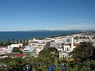
East Coast
On the East Coast of the North Island you are close to the Hikurangi tectonic plate boundary. This is the boundary between the Australian plate and the Pacific plate.
Hikurangi plate boundary
At the Hikurangi tectonic plate boundary the Australian and Pacific plates are pushing against each other.
The Australian plate is a lighter continental plate and the Pacific plate is a heavier oceanic plate. At this boundary, the Pacific plate is slowly moving under the Australian plate. This process is called subduction.
As the Pacific plate moves under the Australian plate it melts and forms molten or partly molten rock below the Earth’s surface called magma. Magma builds up and creates pressure under the earth’s surface and when this pressure is released it can cause earthquakes, tsunami, or volcanic eruptions.

The Hikurangi subduction zone
The Hikurangi subduction zone is not well understood, yet it could be the largest source of earthquake and tsunami hazard in New Zealand. Subduction zones are a type of fault and can cause the largest and most powerful earthquakes and tsunamis in the world, such as
- Sumatra 2004
- Chile 2010
- Japan 2011.
We know that the Hikurangi subduction zone can produce large earthquakes and tsunamis, and that these events have happened in the past. However, we don’t know how often these earthquakes tend to happen, nor do we know how large they can be.
A large team of national and international scientists will be studying the Hikurangi plate boundary to find out what risk it poses to New Zealand.
 This project will involve:
- Building and installing seafloor sensors to measure sudden earthquakes and slow slip events
- Using specialised research ships to carry out sea bed drilling and imaging of the sea floor to find out more about rock types
- Gathering geological evidence of past Hikurangi earthquakes and tsunami
- Working with iwi to understand how earthquakes and tsunami effected Māori.