

On unstable ground
Exploring landslide risks and management
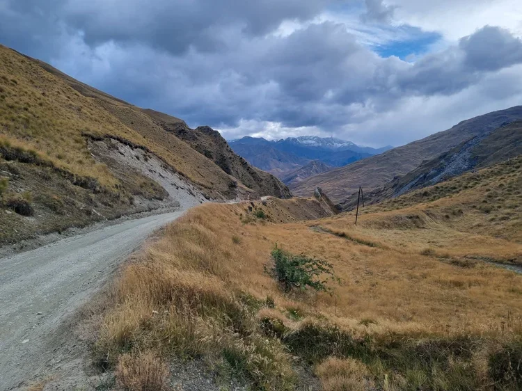
About this field trip
Aotearoa is a land of incredible scenery. The tectonic forces that have created our beautiful landscapes also make them prone to natural hazards such as earthquakes, volcanoes, tsunami and landslides. Of all these natural hazards, landslides are the most costly, causing more loss of life than earthquakes and volcanoes combined.
On this field trip, we’ll take you from urban Tahuna ❘ Queenstown to the rural Cromwell Gorge ❘ Tīrau and its famous Clyde Dam on the Mata-Au River. Expert geoscientists will guide you on this journey to explore different types of landslides, their causes, how to prepare for them, and what engineers do to manage their impacts.
Objectives
The objectives of this virtual field trip are to:
increase awareness and understanding of Earth’s dynamic systems and natural hazard processes
highlight the causes and effects of landslides and how they impact people and infrastructure
equip participants with the knowledge and skills to prepare for and respond to landslides.
Key learning
Through this field trip, participants will:
explore landslides and debris flows
understand what causes these hazards and how they affect communities
learn how geoscientists monitor, mitigate and respond to ongoing land movement and landslide events
discover how to prepare for an emergency and how to look after yourself and others.
Student-led inquiry
Empower your ākonga to take charge of their learning journey. Encourage them to ask meaningful questions, explore resources, and embark on their own journey of natural hazard preparedness.
Curriculum alignment
This virtual field trip aligns with the refreshed New Zealand Curriculum (2022). It covers a range of learning areas, predominantly science and social sciences. Access guidance that supports teaching and learning to align with curriculum goals.
Be prepared – Stay safe – Understand your world
Join us on this LEARNZ adventure and become part of a generation ready to face natural hazards with knowledge, courage, and care.
This online field trip is generously supported by Natural Hazards Commission Toka Tū Ake

Signing up helps us to report on who is using LEARNZ so we can keep funding it
Educator guide
This guide is designed to support teachers in aligning the LEARNZ On unstable ground virtual field trip with the goals, structure, and learning outcomes of The New Zealand Curriculum refresh. It outlines the key learning intentions, suggests cross-curricular links, and provides examples of teaching and learning opportunities that are meaningful, place-based, and action-oriented.
Learning objectives
The virtual field trip is designed to:
increase understanding of Earth’s dynamic systems and how natural hazards occur
explore the social and environmental impacts of landslides
develop ākonga knowledge and skills to prepare for and respond to landslides and other emergencies
empower student-led inquiry and action.
Curriculum vision and values
This field trip supports the vision of The New Zealand Curriculum refresh by helping ākonga to:
contribute confidently to communities that are informed and prepared
value the whenua, understanding place-based risks and histories
respect multiple knowledge systems, including mātauranga Māori and science
act with care and responsibility toward themselves, others, and their environment.
Curriculum learning areas and Mātauranga Māori
-
Phase 2 (Years 4–6)
Strand: Geography
Patterns and processes: Patterns in the visible features of places (landscapes) are shaped by processes, and influence how people live.
Knowledge During Year 5
Conceptual knowledge
Landform processes create distinctive landscape patterns that influence people’s use.
Landscape formation and use in New Zealand
Differences in landforms (mountains, volcanic, plains, lowlands, hill country) create a variety of landscapes (e.g. Southern Alps, Volcanic Plateau, King Country, Te Urewera, Canterbury Plains, Southland Plains).
Processes responsible for New Zealand’s diverse landscapes
Plate tectonics such as plate collision and volcanic eruptions play a major role in forming New Zealand’s landscapes.
Landscapes are also shaped by the processes of erosion and deposition, fluvial (river) processes, glacial (ice) processes, and mass movement (landslips).
Interactions between landscapes and people
Some human uses are based on modifications of the landscape such as hydro–electric power on rivers and irrigation. People have different perspectives on the value of these modifications.
In te ao Māori hapū and iwi have explanations of landscape formation and a sense of connection to the natural world that brings with it the responsibilities of guardianship, protection, and preservation (kaitiakitanga /guardianship).
In te ao Māori mountains and rivers are often considered and recognised as tipuna (ancestor), which are personified, living entities (e.g. Te Urewera, Taranaki maunga, Whakaari White Island).
Case study: Local landform landscape
The landforms of the local area have a distinctive physical appearance resulting from natural processes that have formed and modified them.
There are different narratives about the naming of local landforms. Hapū and iwi have narratives about their formation and naming.
The landforms of the local area have shaped people’s activities and have been shaped by those activities
Practices During Year 5
Think conceptually
Define, explain, and use concepts of landscape formation and people-environment interaction.
Frame questions
Ask interpretive questions, for example:
o Why does this landscape look like that?
o Why do people choose to use the land the way they do?
Process information by:
Using relief maps, aerial photographs, and cross–sections to identify landscape features.
Using diagrams to show how tectonic processes and different erosion and deposition processes work.
Using photographs to collect information on how people use different landscapes.
Optional: Carrying out fieldwork on the landform features of the local landscape.
Identify values and perspectives by, for example:
Comparing views for and against the use of a natural landscape for human modification (e.g. for hydro and solar power or irrigated farming).
Comparing the ways that different individuals and groups (e.g. hapū and iwi, conservationists, farmers, developers) view and use particular natural landscapes.
Communicate findings and conceptual knowledge by:
Describing landform differences from place to place, and the reasons for those differences (landscape formation).
Describing human–use of different landscapes, and how the landscape has influenced those uses (people–environment interaction).
Design, implement, and evaluate social actions by, for example:
Surveying people about the features of the local natural landscape that are important to them and why
Considering actions that you can take to preserve and enhance valued natural features.
Phase 3 (Years 7–8)
Strand: Geography
Environmental change: Environmental change is driven by human activities and natural processes.
Knowledge During Year 8
Conceptual knowledge
Natural processes interact with human activities to create environmental impacts that affect people.
Natural hazards in New Zealand
Note: The two prescribed illustrative examples are floods and earthquakes; however, teachers in areas affected by natural hazards may choose to replace one of these with volcanoes, tsunami, or landslides if it better reflects the experiences of students in their class.
Natural processes affect landforms and become hazards when they pose a risk to life or property.
‘The four R’s’ (Reduction, Readiness, Response, Recovery) underpin the emergency management system in New Zealand.
Consequences for people affected by natural disasters include loss of life, loss of property and marae, damage to urupā (burial grounds), damage to infrastructure, siltation, damage to transport links, disruption to lives and livelihoods, psychological, and long–term health impacts.
Hazard management – exemplified through case studies
The ability of a community to manage hazards is influenced by accessibility, costs, and available resources, and how they come together to support each other.
Short–term responses include search and rescue, marae as a focal point for support, response and recovery, provision of essentials, temporary fixes, financial aid, and humanitarian assistance and citizen–initiated volunteering.
Longer–term responses include reconstruction and mitigation but may also include relocation.
Practices During Year 8
Think conceptually
Define, explain, and apply concepts of natural processes and environmental impact, and make connections between these concepts.
Frame questions
Develop analysis questions that investigate why events or patterns occur, for example: ‘Why are some places more vulnerable to natural hazards than others?’
Use questions to explore causes and impacts, for example:
o What causes particular hazards?
o What are the immediate and longer–term impacts of particular hazards?
Process information by:
Using topographic maps and other tools to identify and investigate the shape of the land in flood–prone areas.
Using diagrams to show the natural processes that create different types of hazards.
Using flow diagrams to show the sequence of events in a hazard from cause to impact and response.
Using quantitative data (e.g. casualties, costs) and qualitative sources (e.g. images, accounts of eyewitnesses) to describe the impact of hazards.
Optional: Carrying out local fieldwork to test the local awa (river) for debris or loss of vegetation cover that may contribute to flooding, or to investigate the impact of impermeable surfaces.
Optional: Surveying people to gather their opinions about perceptions of hazard risk.
Identify values and perspectives by, for example:
Evaluating the values behind the actions of groups such as marae and volunteer organisations in their response to hazards.
Analysing and comparing points of view about responsibilities in relation to natural hazards (e.g. whether people should be allowed to live in high–risk places).
Communicate findings and conceptual knowledge by:
Describing the natural processes that create hazards, and the environmental impacts and changes to people’s lives that result from those hazards.
Describing the natural hazards response plan in your local area.
Design, implement, and evaluate social actions by, for example:
Considering how people could contribute to support communities affected by hazardous events.
Considering how people could raise awareness of Civil Defence practices in New Zealand.
-
Phase 3 (Years 7-8)
Oral Language
Communicating and Presenting
Verbal reasoningKnowledge:
Precise and purposeful language is needed to analyse ideas, critique perspectives, interpret meaning, and structure arguments clearly for listeners.
Creating and answering questions supports deep thinking by exploring different perspectives, testing assumptions, and considering possible consequences.
Practices:
Asking and answering open-ended questions that test assumptions and consider possible consequences.
Using spoken language to make inferences and draw conclusions by interpreting ideas, justifying thinking, and using evidence from discussion or experience.
Reading
Comprehension
VocabularyKnowledge:
Expanding vocabulary, especially academic and content-specific terms, is essential for interpreting and engaging with increasingly complex texts.
Practices:
Using a range of strategies to ascertain the meaning of academic and content-specific words and phrases in year-level texts.
Using year-appropriate academic and content-specific words and phrases with accuracy.
Comprehension strategies
Knowledge:
Readers monitor and actively manage their understanding while reading a variety of texts and sources, by applying a range of strategies — such as annotating, rereading, reading ahead, asking questions, visualising, and consulting references — to support continued meaning making.
Practices
Identifying and summarising key ideas and themes in texts, explaining how supporting details develop and connect these ideas.
Writing
Composition
Writing to informKnowledge:
Informative texts are written to communicate information, explain ideas, or present arguments clearly and logically.
Practices:
Writing texts to inform that:
clearly introduce the topic and organise ideas and information logically into paragraphs
include headings and visual features such as illustrations, charts, tables, and multimedia (when useful for aiding comprehension)
include words and phrases to clarify, illustrate, or compare ideas.
Learning activities:
Write a news article or report on a natural hazard event.
Present a video journal from the perspective of someone affected by a disaster.
Design infographics or public service announcements about being prepared.
Create a poster informing people of the signs of unstable land and what to do if there is a landslide.
-
Focus concepts: Whakapapa o te whenua, kaitiakitanga, mātauranga ā-iwi
Learning outcomes:
Understand Māori perspectives on the land, signs of natural change, and ancestral stories.
Learn how iwi and hapū prepare for and respond to natural hazards.
Learning activities:
Explore local pūrākau about natural events or landmarks.
Compare local iwi knowledge with scientific predictions.
Create a visual story (poster, animation, or mural) of how mātauranga Māori informs hazard awareness.

This field trip aligns with SDG 15: Life on Land. It emphasises the significance of terrestrial biodiversity, promoting awareness of conservation efforts at Sanctuary Mountain Maungatautari.
By fostering understanding of the interconnectedness between people and the environment, it contributes to the broader global goals of preserving and protecting life on land for sustainable development.
Stay updated
Join us on this educational adventure. Stay updated on our progress, news, and events related to the virtual field trip by following us on social media.
Discover more
Select a topic or image link for background information, images, narrations, and kupu Māori | key words for each topic.
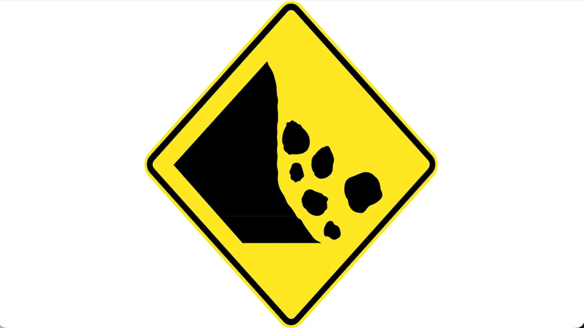
What is a Landslide?
A landslide occurs when earth, rock, vegetation, mud, or dirt suddenly loses its grip…
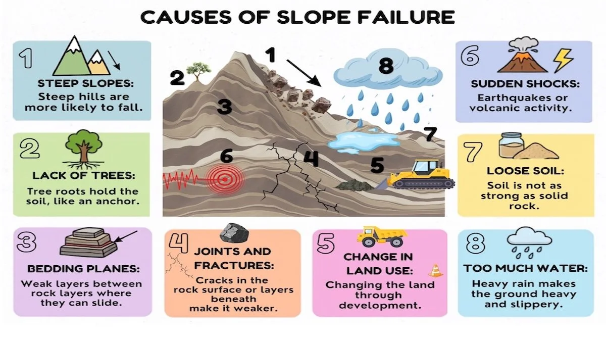
Landslide Triggers
Several things can cause landslides, but the main ingredients are water, shaky ground, and changes to the land.
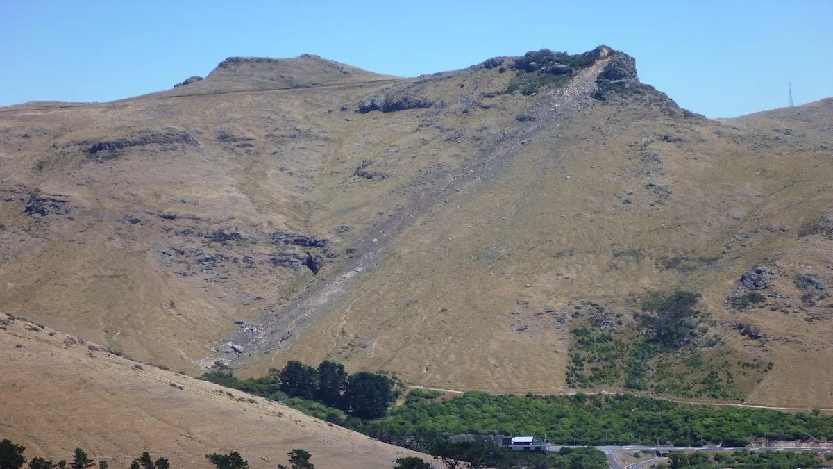
Landslide Impacts
Landslides are common and can happen anywhere in the world. It’s estimated that 400,000 landslides…
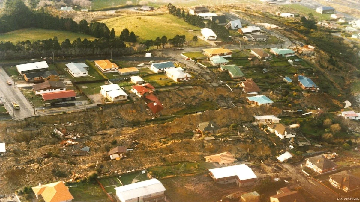
Landslides in Aotearoa
Landslides are a natural process that remove material from hills, mountains and coastlines.
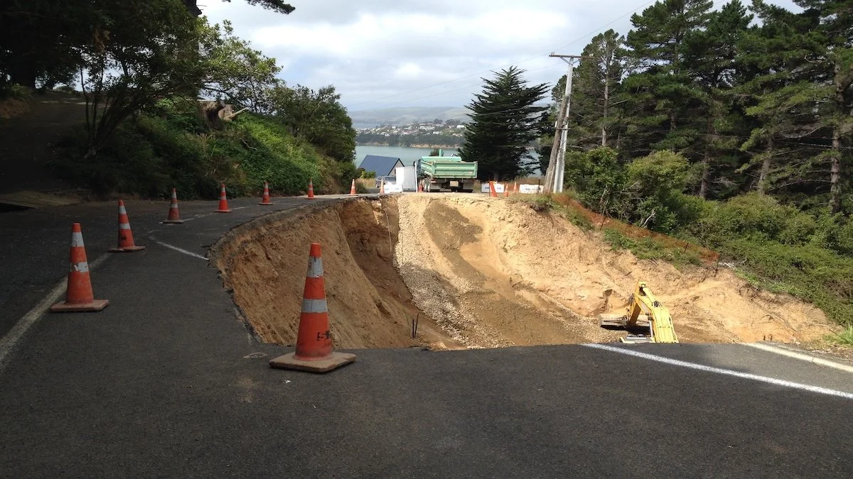
Living with Landslides
Landslides are a big problem in Aotearoa.
Landslides have killed more people than all other natural hazards combined.
Landslides cost this country, on average, $250 to 300 million dollars a year.
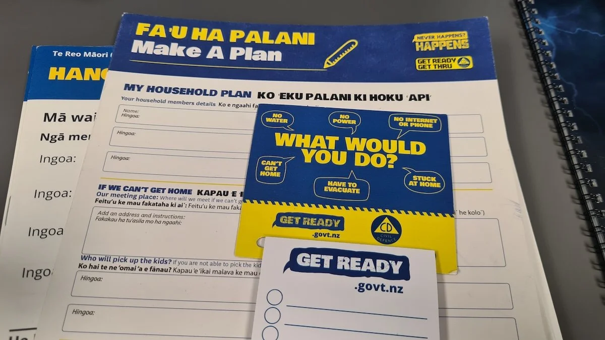
Preparing for Landslides
We can’t predict when natural disasters will occur, but we can prepare for them. One of the best places to start is with your home.
Connect with field trip experts
Insights into people and their careers.
Meet Beth
Beth is an Engineering Geologist who works for WSP, an engineering and professional services consulting firm.
Meet Blake
Blake is an Engineering Geologist who works for ENGEO – a firm of geotechnical engineers, geologists, environmental scientists and hydrologists.
Meet Courtenay
Courtenay is the Emergency Management team leader in Central Otago.
Explore the field trip videos
Join our field trip experts as we visit new places and learn new things.
Landslide Causes and Effects
Venture up Coronet Peak and stand upon an ancient landslide with Blake, an Engineering Geologist. Discover why Aotearoa has so many landslides and the impacts different landslide types have here in Central Otago.
Check your understanding
What is a landslide and how are landslides triggered?
Why are landslides so common in Aotearoa New Zealand?
What types of landslides are common in Central Otago?
Hazard Mapping
Look at a new urban development in Tāhuna Queenstown to see how natural hazards are identified and mapped before deciding on the best way to manage future impacts.
Check your understanding
What is the main hazard in this area and how was it identified?
Where can you find information about hazards in your local area?
How does the rockfall fence work?
Anchor Systems
See how Beth, an Engineering Geologist works safely on the cliff face at Nevis Bluff and what work she does on site.
Check your understanding
What is a via ferrata?
What work does Beth complete while using the via ferrata?
What work does the ‘Abseil Management Team’ do?
Getting Cut Off
Landslides can damage roads and cut off communities. Visit Nevis Bluff, east of Tāhuna Queenstown, to see how the risk of rockfall is managed above a busy highway.
Check your understanding
How big is the Nevis Bluff rockfall hazard?
How many rockfall hazard features are managed across the Nevis Bluff?
Why is Nevis Bluff geologically unstable?
Protecting Infrastructure
Discover how a team of people work to keep Nevis Bluff safe for people travelling on State Highway 6 between Tīrau Cromwell and Tāhuna Queenstown.
Check your understanding
Why is blasting not used very often to remove rock from Nevis Bluff?
What is rock scaling and how is it done at Nevis Bluff?
How deep into the rock do the rock bolts go at the ‘mid-stream columns on Nevis Bluff?
Managing and Mitigation
Travel down the gorge to discover how a major piece of infrastructure is protected from multiple landslide risks.
Check your understanding
What is the important piece of infrastructure that needs protecting from landslides in Tīrau Cromwell Gorge?
Why are landslides a risk in this area?
What has been done to reduce movement on landslides within the gorge?
Inside a Landslide
Venture inside a landslide through a tunnel above the Clyde Dam. See how landslides can be monitored and take a closer look at some rock layers within the landslide.
Check your understanding
What do you think is monitored from this tunnel?
Managing Drainage and Slopes
Walk up on to the Frankton landslide in Tāhuna Queenstown to kōrero with Beth, an Engineering Geologist and Courtney, the team leader of Emergency Management Otago. Find out how this landslide is managed and what we should do to prepare for future landslide events.
Check your understanding
How is the Frankton landslide managed?
What should you do if you notice a landslide or signs of land movement?
How can you prepare for natural hazards such as landslides?
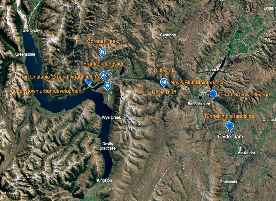
Take the Google Earth tour
Take the Google Earth for Web Tour
A virtual tour of the field trip with GIS mapping, 3D locations, 360° panoramic images, videos, and further information.
Web conference
Replay the field trip web conference
Resources
Useful links
NHC Toka Tū Ake | Museum and schools programme
Part of the Natural Hazards Commission’s outreach work is to help raise hazard-aware Kiwis and support the understanding of natural forces that have shaped the land.
NHC | Natural hazards portal
Find out about landslide and natural hazard risk in Aotearoa New Zealand, and see how previous events have impacted a property by looking at past Natural Hazards Commission claims.
GNS Science Te Pū Ao | Natural hazards and risks | Ngā Matepā me ngā Tūraru ā Taiao
Earth Sciences NZ has a national leadership role in monitoring and researching the causes, risks and consequences of geological hazards in Aotearoa New Zealand, including landslides.
GeoNet
Check recent earthquakes, landslides and volcano alert levels.
Get Ready
Learn more about natural hazards in Aotearoa and how to prepare.
What's the Plan Stan?
A free resource to support schools, teachers and students to develop the knowledge and skills to prepare for emergency events.
Te Ara The Encyclopedia of New Zealand
A story on landslides including causes, types, examples and living with landslides.
New Zealand disasters With thanks to Christchurch City Libraries:
Landslides book
Download this book for tamariki from Hono the Māori Emergency Management Network and Te Tira Whakamātaki.
The Big Dig
Read this journal article on clearing the Manawatū Gorge Slip and download the literacy resource from Tāhurangi.
Glossary
Active fault
A fault that is likely to have another earthquake sometime in the future. Faults are commonly considered to be active if they have moved in the last 10,000 years.
Alpine Fault
Major fault line running through the South Island where the Indo-Australian and Pacific Plates collide.
Ash
Volcanic ash consists of rock, mineral, and volcanic glass fragments, which are slightly larger than the size of a pinhead. Volcanic ash is like finely crushed window glass and is not soft like ash from wood and paper. It is made of rocks that shattered into tiny pieces during an eruption.
Avalanche
A mass of snow, ice, and rocks falling rapidly down a slope.
Bedrock
The solid rock that lies under weathered rock and loose surface deposits such as soil.
Basalt
Basalt is a hard, fine-grained black volcanic rock. It has low viscosity, which means it flows easily. The main minerals in basalt include olivine, pyroxene, and plagioclase. Basalt erupts at temperatures between 1100°C and 1250°C. Basalt is the most common rock type in the Earth's crust.
Continent
An enormous, unbroken area of land. Earth's surface is divided into Africa, Antarctica, Asia, Australia, Europe, North America and South America.
Continental drift
The movement of the Earth's crust (plates).
Crater
A large bowl-shaped cavity caused by an explosion or an impact. In reference to volcanoes, it forms after a volcanic eruption.
Crust
The outermost layer of the Earth, ranging from 10 to 65km in thickness worldwide. The uppermost 15-3 km of crust is brittle enough to produce earthquakes.
Debris
Broken and detached fragments, usually detached from a rock or mountain, and often piled up at the base.
Density
The weight of a known volume of material.
Earthquake
A sudden movement of the Earth's crust caused by the release of stress accumulated along geologic faults or by volcanic activity.
Epicentre
The point on the Earth's surface vertically above the hypocentre.
Erosion
Process of wearing away and transporting of rocks by wind, rain or ice.
Fault
A break in rock across which there is observable movement.
Fault trace
A visible break in the surface of the land caused by movement along a fault.
Fissure
A long narrow crack in the ground caused by earthquakes.
Fold
A rock layer that has been bent by pressure.
Geologist
A scientist trained in the study of the Earth.
Geology
The science of the make-up, shape and history of the Earth.
Geosyncline
Massive trough (depression) in the Earth's crust which fills with sediments.
Gondwana
When the ancient Pangaea split into two continents, Gondwana was the southern landmass. It included most of Africa, Madagascar, India, Australia, Antarctica and parts of South America.
Horo whenua
The Māori word for landslide
Hydrothermal activity
Hot springs, geysers and warm ground created by heat from nearby volcanic activity.
Intensity
A measure of how strongly an earthquake manifests at the surface, based on its observable effects on people, buildings and the environment. Intensity is usually ranked using the 12-point Modified Mercalli Intensity (MMI) scale.
Landslide
The movement of a mass of rock, debris, or earth down a slope.
Landslide dam
When landslide debris blocks a stream or river, there are two parts to a landslide that dams a river: the landslide itself and the lake or pond that forms because of the landslide blocking the watercourse.
Landslide runout
The covering of an area by rock, debris, soil, and other material that is travelling downslope from the area in which the landslide starts.
Magnitude
A measure of the energy released by an earthquake at its source. Magnitude is commonly determined from the shaking recorded on a seismograph. Each unit of magnitude on the scale represents a substantial increase in energy; for example, magnitude 6 releases 30 times as much energy as magnitude 5.
Plate boundaries
The edges of the plates that make up the crust of the Earth.
Plates
Blocks of the Earth's continental and oceanic crust.
Regolith
Loose unconsolidated rock and dust or soil that sits atop a layer of bedrock.
Retaining wall
A structure designed to hold back soil, often constructed from materials such as rock, concrete, and masonry. Retaining walls are built to keep the land behind them from sliding away.
Rocks
Rocks are the hard mineral material of the Earth's crust. They can be either on the surface or underground. They are a mixture of minerals, mineral matter, or organic materials. Sedimentary rocks are formed by weathering and mechanical sorting on the Earth's surface. They include sandstone, limestone and shale. Metamorphic rocks are rocks that have been transformed by the effects of high temperature and pressure. They include schist, marble, and gneiss. Igneous, or volcanic, rocks form from magma. They include basalt, andesite, and rhyolite.
Rūaumoko (or Rūamoko)
In Māori tradition, earthquakes are caused by Rūaumoko - the god of earthquakes and volcanoes.
Rū
The Māori word for earthquake or to shake
Scarp
A steep slope, especially one formed by erosion or faulting.
Sediment
Small particles of rock carried by water, air or ice.
Sedimentary rock
Formed from particles of pre-existing rock, which are carried and deposited by water, wind or ice.
Seismic waves
The waves of energy released by an earthquake.
Slippage
The movement or loss of land from a slope when a landslide occurs beneath it.
Slumping
When loosely consolidated materials or rock layers move a short distance downslope.
Strata
A particular layer of a rock.
Subduction zone
The area or zone where two tectonic plates come together, one riding over the other.
Tectonic
The idea that the Earth's surface is a series of moving plates.
Tsunami
A series of powerful ocean surges caused by a large volume of the ocean floor being displaced – often by an undersea earthquake or landslide.
Tectonic uplift
Elevation of the ground caused by plate movement.
Toe
The lower, usually curved end of a landslide; it is the most distant from the main scarp.
Viscosity
The more viscous a material is, the less likely it is to flow easily. The greater a material's viscosity, the greater its resistance to flow. Basalt lava has a low viscosity, so it flows more easily and farther than other lavas.
Viscous
If something is viscous, it has a thick, sticky consistency between solid and liquid. It does not flow easily.
Volcano
A volcano is a vent at the Earth's surface through which magma and volcanic gases erupt. It is also the cone built by effusive and phreatic eruptions.